
IMAGES TAKEN NEAR TO
Hurst Way, SOUTH CROYDON, CR2 7AP
Introduction
This page details the photographs taken nearby to Hurst Way, CR2 7AP by members of the Geograph project.
The Geograph project started in 2005 with the aim of publishing, organising and preserving representative images for every square kilometre of Great Britain, Ireland and the Isle of Man.

There are currently over 7.5m images from over14,400 individuals and you can help contribute to the project by visiting https://www.geograph.org.uk
Image Map
Images are licensed for reuse under creativecommons.org/licenses/by-sa/2.0
Notes
- Clicking on the map will re-center to the selected point.
- The higher the marker number, the further away the image location is from the centre of the postcode.
Image Listing (54 Images Found)
Images are licensed for reuse under creativecommons.org/licenses/by-sa/2.0
Image
Details
Distance
2
South Croydon
Emmanuel Church, seen from Harewood Road.
Image: © Peter Trimming
Taken: 19 Apr 2020
0.09 miles
4
South Croydon, Surrey: Emmanuel Church
Image: © Dr Neil Clifton
Taken: 30 Nov 2011
0.10 miles
5
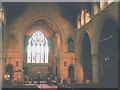
Interior of Emmanuel church
Emmanuel (Anglican) parish church on Normanton Road. It was built in 1899 to the designs of architect T. Roger Smith.
Image: © Stephen Craven
Taken: 18 Sep 2003
0.11 miles
6
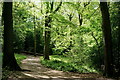
Croham Hurst
The northwestern corner, looking along one of the main paths.
Image: © Peter Trimming
Taken: 25 Apr 2020
0.12 miles
8
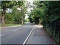
B275 Selsdon Road, Sanderstead CR2
Looking southeast from the end of Croham Manor Road. Croham Hurst woods are on the left, just around the bend.
Image: © Philip Talmage
Taken: 4 Sep 2005
0.13 miles
9
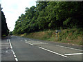
Croham Hurst, South Croydon CR2
An 85-acre woodland Site of Special Scientific Interest (S.S.S.I.) This view is from the B275 Upper Selsdon Road, by the end of Elmfield Way, looking northwest. http://www.croydon.gov.uk/leisure/parksandopenspaces/parksatoz/croham/chhistory for historical information.
Image: © Philip Talmage
Taken: 4 Sep 2005
0.13 miles
10
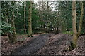
Croham Hurst
Areas marked for holly removal, during the winter months.
Image: © Peter Trimming
Taken: 17 Jan 2021
0.13 miles