
IMAGES TAKEN NEAR TO
Sunny Nook Gardens, SOUTH CROYDON, CR2 6PX
Introduction
This page details the photographs taken nearby to Sunny Nook Gardens, CR2 6PX by members of the Geograph project.
The Geograph project started in 2005 with the aim of publishing, organising and preserving representative images for every square kilometre of Great Britain, Ireland and the Isle of Man.

There are currently over 7.5m images from over14,400 individuals and you can help contribute to the project by visiting https://www.geograph.org.uk
Image Map
Images are licensed for reuse under creativecommons.org/licenses/by-sa/2.0
Notes
- Clicking on the map will re-center to the selected point.
- The higher the marker number, the further away the image location is from the centre of the postcode.
Image Listing (69 Images Found)
Images are licensed for reuse under creativecommons.org/licenses/by-sa/2.0
Image
Details
Distance
1
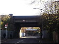
Bridges on Sussex Road
Sussex Road leads from Selsdon Road towards Moreton Road.
It passes under the railway line between South Croydon and Purley Oaks, and then the railway line between South Croydon and Sanderstead.
Image: © David Anstiss
Taken: 13 Nov 2011
0.03 miles
2
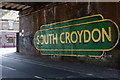
South Croydon
Sussex Road, with the bridge which carries the mainline London to Brighton railway.
Image: © Peter Trimming
Taken: 27 Mar 2020
0.03 miles
3
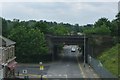
Sussex Road passes under the London to Brighton railway
South of South Croydon Station.
Image: © Russel Wills
Taken: 17 May 2014
0.03 miles
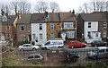
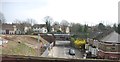
6
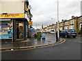
Junction Road at the corner of Selsdon Road
Image: © David Howard
Taken: 29 Oct 2012
0.07 miles
7
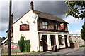
The View Public House South Croydon
This pub used to be called the Rail View and is located in Selsdon Road, South Croydon.
Image: © JOHN PARKIN
Taken: 1 Sep 2009
0.08 miles
8
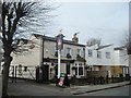
The Crown and Sceptre public house, South Croydon
Image: © Stacey Harris
Taken: 5 Apr 2010
0.09 miles
9
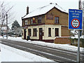
The View, South Croydon
On Selsdon Road.
Image: © Robin Webster
Taken: 19 Dec 2010
0.11 miles
10
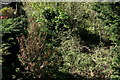
South Croydon
The overgrown trackbed of the former Woodside and South Croydon Joint Railway (opened 1885, closed 1983), looking towards the location of the Selsdon Road station.
Image: © Peter Trimming
Taken: 19 Apr 2020
0.11 miles