IMAGES TAKEN NEAR TO
Palace View, CROYDON, CR0 8QY
Introduction
This page details the photographs taken nearby to Palace View, CR0 8QY by members of the Geograph project.
The Geograph project started in 2005 with the aim of publishing, organising and preserving representative images for every square kilometre of Great Britain, Ireland and the Isle of Man.

There are currently over 7.5m images from over14,400 individuals and you can help contribute to the project by visiting https://www.geograph.org.uk
Image Map
Images are licensed for reuse under creativecommons.org/licenses/by-sa/2.0
Notes
- Clicking on the map will re-center to the selected point.
- The higher the marker number, the further away the image location is from the centre of the postcode.
Image Listing (61 Images Found)
Images are licensed for reuse under creativecommons.org/licenses/by-sa/2.0
Image
Details
Distance
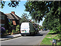
1
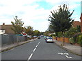
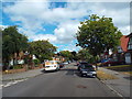
Eversley Way, Shirley
Eversley Way is a residential road in Shirley, in South London's outer suburbs.
The bicycle marking on the road indicates that the road forms part of a signposted route for cyclists. it is part of National Cycle Network route 21.
Image: © Malc McDonald
Taken: 21 Aug 2016
0.02 miles
2
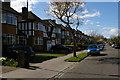
Palace View, Shirley
Palace View is a residential road in Shirley, in outer South London.
The road name almost certainly refers to nearby Addington Palace, a nearby mansion.
Image: © Malc McDonald
Taken: 21 Aug 2016
0.04 miles
4
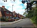
Palace View, Spring Park
It's not clear where this road takes its name from: Addington Palace is the other side of a hill, and it's a long way from Crystal Palace.
This end of the road is part of National Cycle Route 21.
Image: © Stephen Craven
Taken: 24 Jul 2011
0.04 miles
5
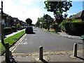
Bridle Road, Shirley
Bridle Road in Shirley, in outer South London.
Image: © Malc McDonald
Taken: 21 Aug 2016
0.07 miles
6
Bridle Road, Spring Park
The southern end of the road, seen from its junction with Palace View Image
Image: © Stephen Craven
Taken: 24 Jul 2011
0.08 miles
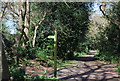
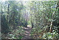
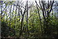
7
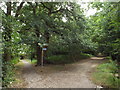
Paths on Shirley Heath
Paths through woodland in outer South London.
The path to the right is part of National Cycle Network route 21, indicated by the blue sign.
Image: © Malc McDonald
Taken: 21 Aug 2016
0.09 miles