IMAGES TAKEN NEAR TO
Furlong Close, CROYDON, CR0 7DX
Introduction
This page details the photographs taken nearby to Furlong Close, CR0 7DX by members of the Geograph project.
The Geograph project started in 2005 with the aim of publishing, organising and preserving representative images for every square kilometre of Great Britain, Ireland and the Isle of Man.

There are currently over 7.5m images from over14,400 individuals and you can help contribute to the project by visiting https://www.geograph.org.uk
Image Map
Images are licensed for reuse under creativecommons.org/licenses/by-sa/2.0
Notes
- Clicking on the map will re-center to the selected point.
- The higher the marker number, the further away the image location is from the centre of the postcode.
Image Listing (44 Images Found)
Images are licensed for reuse under creativecommons.org/licenses/by-sa/2.0
Image
Details
Distance
1
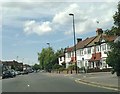
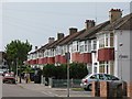
Shirley Park Road, Addiscombe
Shirley Park Road is a residential road in Addiscombe, in the suburbs of south London. The road ends as a cul-de-sac
Image: © Malc McDonald
Taken: 18 Jun 2022
0.06 miles
2
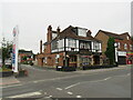
The Cricketers, Addiscombe, near Croydon
The Cricketers pub in Addiscombe, in the outer suburbs of south London.
Image: © Malc McDonald
Taken: 18 Jun 2022
0.06 miles
3
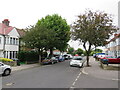
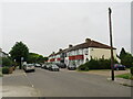
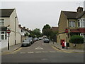
Bingham Road, Addiscombe, near Croydon
Bingham Road is a residential road in Addiscombe, in the outer suburbs of south London. Road signs indicate that a speed limit of 20 miles per hour applies to this road.
Image: © Malc McDonald
Taken: 18 Jun 2022
0.07 miles
4
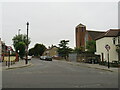
Glenthorne Avenue, CR0
West of its junction with Blackthorne Avenue.
Image: © Mike Quinn
Taken: 26 May 2010
0.08 miles
5
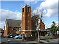
Our Lady of the Annunciation Church, Addiscombe
This church stands near the junction of Bingham Road and Shirley Road.
Image: © Peter Trimming
Taken: 6 Mar 2009
0.09 miles
6
Glenthorne Avenue, Addiscombe
Glenthorne Avenue is a residential road in Addiscombe, in the south London suburbs.
Image: © Malc McDonald
Taken: 18 Jun 2022
0.10 miles
7
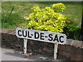
Cul-de-sac sign in Glenthorne Avenue, CR0
See Image For everything you ever wanted to know about culs-de-sac, including "filtered permeability", see the Wiki entry http://en.wikipedia.org/wiki/Cul-de-sac.
Image: © Mike Quinn
Taken: 26 May 2010
0.10 miles
8
Elmgrove Road, Addiscombe
Elmgrove Road is a residential road in Addiscombe, in the outer suburbs of south London.
Image: © Malc McDonald
Taken: 18 Jun 2022
0.10 miles
9
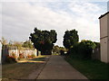
Blackthorne Avenue, Shirley
This track leads from Glenthorne Avenue towards a large allotment area.
Image: © David Anstiss
Taken: 16 Oct 2011
0.12 miles