
IMAGES TAKEN NEAR TO
Swinburne Crescent, CROYDON, CR0 7BY
Introduction
This page details the photographs taken nearby to Swinburne Crescent, CR0 7BY by members of the Geograph project.
The Geograph project started in 2005 with the aim of publishing, organising and preserving representative images for every square kilometre of Great Britain, Ireland and the Isle of Man.

There are currently over 7.5m images from over14,400 individuals and you can help contribute to the project by visiting https://www.geograph.org.uk
Image Map
Images are licensed for reuse under creativecommons.org/licenses/by-sa/2.0
Notes
- Clicking on the map will re-center to the selected point.
- The higher the marker number, the further away the image location is from the centre of the postcode.
Image Listing (42 Images Found)
Images are licensed for reuse under creativecommons.org/licenses/by-sa/2.0
Image
Details
Distance
2
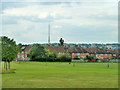
View towards Croydon TV transmitter
Looking across Ashburton Playing Fields. The tower is in fact at Upper Norwood. This viewpoint also gives views of the very similar Crystal Palace transmitter, further around to the right and actually at Crystal Palace.
Image: © Robin Webster
Taken: 1 Jul 2011
0.10 miles
4
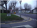
Corner of Stroud Green Way and Long Lane
Image: © David Howard
Taken: 29 Jan 2012
0.12 miles
5
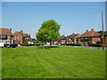
Woodside: Chaucer Green
Houses set around a pleasant green, with a shady plane tree. Surprisingly, no seats.
Image: © Dr Neil Clifton
Taken: 28 May 2012
0.13 miles
6
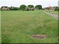
Ashburton Playing Fields, east of Coleridge Road, CR0 (3)
The grille marks a drain, that seems to run WNW parallel to the path, feeding into the St. James Stream.
Image: © Mike Quinn
Taken: 26 May 2010
0.14 miles
7

Ashburton Playing Fields
Seen from the footpath.
Image: © Peter Trimming
Taken: 11 Apr 2020
0.16 miles
8
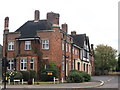
Woodside Fire Station
On the A222 Long Lane.
Image: © David Anstiss
Taken: 16 Oct 2011
0.17 miles
9
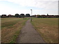
Footpath to Coleridge Road
A path leads from Woodmere Avenue, through Ashburton playing fields.
Image: © David Anstiss
Taken: 16 Oct 2011
0.17 miles
10

(The line of) St. James Stream, Ashburton Playing Fields (10)
Image: © Mike Quinn
Taken: 26 May 2010
0.19 miles