IMAGES TAKEN NEAR TO
Woodside Way, CROYDON, CR0 7AT
Introduction
This page details the photographs taken nearby to Woodside Way, CR0 7AT by members of the Geograph project.
The Geograph project started in 2005 with the aim of publishing, organising and preserving representative images for every square kilometre of Great Britain, Ireland and the Isle of Man.

There are currently over 7.5m images from over14,400 individuals and you can help contribute to the project by visiting https://www.geograph.org.uk
Image Map
Images are licensed for reuse under creativecommons.org/licenses/by-sa/2.0
Notes
- Clicking on the map will re-center to the selected point.
- The higher the marker number, the further away the image location is from the centre of the postcode.
Image Listing (46 Images Found)
Images are licensed for reuse under creativecommons.org/licenses/by-sa/2.0
Image
Details
Distance
2
Academy Shirley Park Primary
An extraordinary order of words on the school sign. Is this in deference to some non-English languages?
Image: © Robin Webster
Taken: 11 Jun 2011
0.08 miles
3
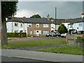
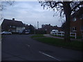
Corner of Stroud Green Way and Long Lane
Image: © David Howard
Taken: 29 Jan 2012
0.08 miles
4
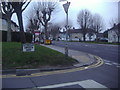
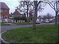
Small close off Longhurst Road
A curious angular terrace of houses with the end houses facing each other across the small roundabout. The arrangement is symmetrical about the angle behind the tree. There must be some very oddly shaped rooms.
Image: © Robin Webster
Taken: 11 Jun 2011
0.10 miles
7
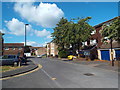
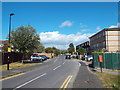
Stockbury Road, near Addiscombe
Stockbury Road runs through a housing estate near Addiscombe, in south London.
Image: © Malc McDonald
Taken: 21 Aug 2016
0.15 miles
8

Woodside station, 2005
View NE, towards Elmers End and London: ex-SE&CR Charing Cross/Cannon Street - Addiscombe until 6/97, also until 1983 to Sanderstead; reopened 5/00 on the Croydon Tramlink line to Elmers End and Beckenham Junction (for details, see Image).
Image: © Ben Brooksbank
Taken: 25 Sep 2005
0.15 miles
9
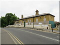
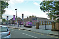
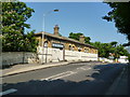
Former station building at Woodside, near Croydon
A former railway station building at Woodside, in the suburbs of south London. The building was built on a bridge over the railway tracks. The railway closed in 1997 so that part of its route could be used for Croydon's tram system, which opened in 2000. There is a tram stop at the site of the railway station, but this is accessed by footpath alongside the station building, rather than through the building itself.
Image: © Malc McDonald
Taken: 18 Jun 2022
0.16 miles
10
Woodside station: remains of
The railway which formerly ran beneath the bridge here has been converted into a tram line, but these disused roadside buildings remain from the railway era
Image: © Dr Neil Clifton
Taken: 28 May 2012
0.17 miles