1
Central Parade, New Addington, CR0
The police notice asks for information about an armed robbery, which took place on 21st July 2005 at this newsagents' shop, at the south-eastern end of the shopping area. Note also the litter, graffiti and steel shutters which characterise the area.
Image: © Philip Talmage
Taken: 20 Aug 2005
0.11 miles
2
New Addington Community Centre, Central Parade, New Addington, CR0
Conceived in the 1930s, the First National Housing Trust began a 'Garden Village' on what was then farmland, as a slum-clearance project. The New Addington estate was mainly developed in the 1950s as a massive semi-rural council estate, and despite right-to-buy amelioration of the social profile, it is still hardly one of the nicer districts. One of the largest estates in London not served by rail, it was a main reason for constructing Tramlink.
Image: © Philip Talmage
Taken: 20 Aug 2005
0.11 miles
3
Bus stop 'D', New Addington
The New Addington Health Centre is visible in the background. This stop is the first picking up point for two routes that start from here, the 314 to Bromley North and the 464 to the 'Old Ship', Tatsfield. The 464 has a half-hourly headway seven days a week; the 314 is more frequent. Both of these routes are worked with single-deck vehicles.
Image: © Dr Neil Clifton
Taken: 8 Dec 2009
0.13 miles
4
Parkway, New Addington
Image: © David Howard
Taken: 13 Apr 2014
0.14 miles
5
The Octagon Cyber Cafe, New Addington
This building was formerly a public convenience. Speaking personally, I wish it still was. The tram terminus is visible in the left background.
Image: © Dr Neil Clifton
Taken: 8 Dec 2009
0.14 miles
6
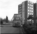
New Addington, Central Parade bus terminus
In February 1985, South Croydon Garage was supplied with a whole brand-new fleet of Class M double deckers for working the local routes. Many, as with M1167 shown here on its first day in service, were allocated to the New Addington routes 130 and 130B. The folly of this quickly became apparent as the buses returned to the garage covered in graffiti and with etched windows. The cerebrally-challenged local youth had been having a field day.
Image: © Dr Neil Clifton
Taken: 23 Feb 1985
0.15 miles
7
Parkway, New Addington
Image: © Paul Gillett
Taken: 12 Jul 2012
0.16 miles
8
Montacute Avenue, New Addington
Image: © Stacey Harris
Taken: 25 May 2009
0.16 miles
9
New Addington Tram Stop
On Central Parade. Tramlink unit 2553 is about to depart for Wimbledon. https://tfl.gov.uk/maps/track/tram
Image: © Mike Faherty
Taken: 19 Mar 2016
0.16 miles
10
New Addington Health Centre
The health centre in the middle of New Addington, in south London's outer suburbs.
Croydon's tram system passes in front of the health centre to reach its terminus just beyond.
Image: © Malc McDonald
Taken: 2 May 2022
0.16 miles


