IMAGES TAKEN NEAR TO
Calley Down Crescent, CROYDON, CR0 0EH
Introduction
This page details the photographs taken nearby to Calley Down Crescent, CR0 0EH by members of the Geograph project.
The Geograph project started in 2005 with the aim of publishing, organising and preserving representative images for every square kilometre of Great Britain, Ireland and the Isle of Man.

There are currently over 7.5m images from over14,400 individuals and you can help contribute to the project by visiting https://www.geograph.org.uk
Image Map
Images are licensed for reuse under creativecommons.org/licenses/by-sa/2.0
Notes
- Clicking on the map will re-center to the selected point.
- The higher the marker number, the further away the image location is from the centre of the postcode.
Image Listing (42 Images Found)
Images are licensed for reuse under creativecommons.org/licenses/by-sa/2.0
Image
Details
Distance
3
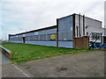
Boarded-up industrial building, New Addington
A "detached industrial unit with offices and yard" according to the agent's sign, extending to 2285 square metres.
Image: © Robin Webster
Taken: 27 Feb 2011
0.11 miles
4
Salvation Army, New Addington
Hall on Hares Bank.
Image: © David Anstiss
Taken: 9 Oct 2011
0.11 miles
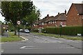
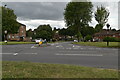
5
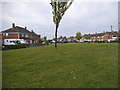
Verge on the corner of Arnhem Drive and King Henry's Drive
Image: © David Howard
Taken: 20 Apr 2014
0.11 miles
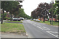
6
King Henry's Drive looking towards Arnhem Drive
Image: © David Howard
Taken: 20 Apr 2014
0.11 miles
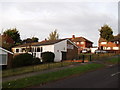
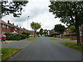
7
New Addington: Arnhem Drive
Originally all these houses were part of the mammoth New Addington council estate. Now, many are in private hands.
Image: © Dr Neil Clifton
Taken: 4 Jun 2012
0.12 miles
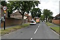
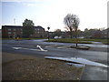
8
Arnhem Drive at the corner of King Henry's Drive
Image: © David Howard
Taken: 20 Apr 2014
0.12 miles
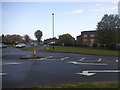
10
New Addington: Warbank Crescent
Shows the northern arm of Warbank Crescent, from its junction with King Henry's Drive.
Image: © Dr Neil Clifton
Taken: 1 Jun 2012
0.12 miles