IMAGES TAKEN NEAR TO
Shair Lane, COLCHESTER, CO7 8QT
Introduction
This page details the photographs taken nearby to Shair Lane, CO7 8QT by members of the Geograph project.
The Geograph project started in 2005 with the aim of publishing, organising and preserving representative images for every square kilometre of Great Britain, Ireland and the Isle of Man.

There are currently over 7.5m images from over14,400 individuals and you can help contribute to the project by visiting https://www.geograph.org.uk
Image Map
Images are licensed for reuse under creativecommons.org/licenses/by-sa/2.0
Notes
- Clicking on the map will re-center to the selected point.
- The higher the marker number, the further away the image location is from the centre of the postcode.
Image Listing (6 Images Found)
Images are licensed for reuse under creativecommons.org/licenses/by-sa/2.0
Image
Details
Distance
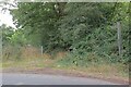
1
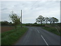
Swallow's Row
Looking north east near Mayfield.
Image: © JThomas
Taken: 24 Apr 2017
0.03 miles
3
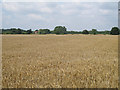
Barley field near Fisher's Farm, Tendring
Image: © Roger Jones
Taken: 25 Aug 2013
0.17 miles
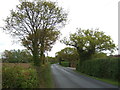
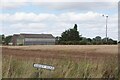
4
Tendring Footpath 15
This path runs for 218m to where it becomes Wheeley footpath 19 this comes out at the A133 B1033 Junction.
Image: © Glyn Baker
Taken: 16 Aug 2024
0.18 miles
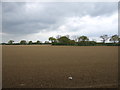
5
Wind Turbine and Eden Farm
At the Image The turbine is not the one marked on the O.S map which was on the other side of Swallow's Row.
Image: © Glyn Baker
Taken: 16 Aug 2024
0.22 miles