IMAGES TAKEN NEAR TO
Marks Hall Road, COLCHESTER, CO6 1TE
Introduction
This page details the photographs taken nearby to Marks Hall Road, CO6 1TE by members of the Geograph project.
The Geograph project started in 2005 with the aim of publishing, organising and preserving representative images for every square kilometre of Great Britain, Ireland and the Isle of Man.

There are currently over 7.5m images from over14,400 individuals and you can help contribute to the project by visiting https://www.geograph.org.uk
Image Map
Images are licensed for reuse under creativecommons.org/licenses/by-sa/2.0
Notes
- Clicking on the map will re-center to the selected point.
- The higher the marker number, the further away the image location is from the centre of the postcode.
Image Listing (13 Images Found)
Images are licensed for reuse under creativecommons.org/licenses/by-sa/2.0
Image
Details
Distance
1
Footpath to the A120 Coggeshall Road
Off Marks Hall Road
Coggeshall Footpath No.21
Image: © Geographer
Taken: 29 Jul 2018
0.09 miles
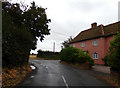
2
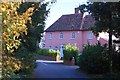
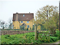
Pink House, near Coggeshall
Seen from the road to Marks Hall, this attractive house stands at the junction of it and Earls Colne Road.
Image: © Trevor Harris
Taken: 12 Oct 2008
0.11 miles
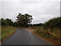
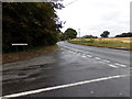
3
Marks Hall Road, Coggeshall
At the junction with the B1024 Colne Road
Image: © Geographer
Taken: 29 Jul 2018
0.11 miles
4
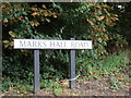
Marks Hall Road sign
On Marks Hall Road at the junction with the B1024 Colne Road near Bouchier's Grange
Image: © Geographer
Taken: 29 Jul 2018
0.11 miles
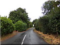
5
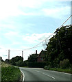
Marks Hall Road, Coggeshall
At the junction with the B1024 Colne Road
Image: © Geographer
Taken: 29 Jul 2018
0.12 miles
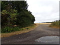
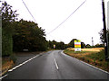
6
Marks Hall Road, Coggeshall
At the junction with the B1024 Colne Road near Bouchier's Grange
Image: © Geographer
Taken: 29 Jul 2018
0.12 miles
7
B1024 Colne Road, Coggeshall
At the junction with Marks Hall Road
Image: © Geographer
Taken: 29 Jul 2018
0.12 miles
8
B1024 Colne Road, Coggeshall
At the junction with Marks Hill Road
Image: © Geographer
Taken: 3 Aug 2014
0.12 miles
9
Bullocks Cross farmhouse
A timber framed grade II listed building, around 1580, altered in 18th and 20th centuries.
Image: © Robin Webster
Taken: 31 Oct 2015
0.19 miles