IMAGES TAKEN NEAR TO
Newbridge Road, COLCHESTER, CO5 9XU

Introduction

This page details the photographs taken nearby to Newbridge Road, CO5 9XU by members of the Geograph project.

The Geograph project started in 2005 with the aim of publishing, organising and preserving representative images for every square kilometre of Great Britain, Ireland and the Isle of Man.

There are currently over 7.5m images from over14,400 individuals and you can help contribute to the project by visiting https://www.geograph.org.uk

Image Map


Images are licensed for reuse under creativecommons.org/licenses/by-sa/2.0
Notes
  • Clicking on the map will re-center to the selected point.
  • The higher the marker number, the further away the image location is from the centre of the postcode.

Image Listing (10 Images Found)

Images are licensed for reuse under creativecommons.org/licenses/by-sa/2.0
Image
Details
Distance
1
Field and road signs
At a crossroads of small lanes between Tiptree and Layer Marney.
Image: © Andrew Hill Taken: 5 Dec 2009
0.12 miles
2
Stockhouse Farmhouse
This farmhouse was up for sale when this photo was taken and it is probably no longer part of a farm judging by the new extension on the right.
Image: © Robert Edwards Taken: 20 Oct 2006
0.13 miles
3
Stackhouse farmhouse and sky with cirrus
The large farmhouse with extension was rather overshadowed by the sky signalling the next low pressure system working in.
Image: © Andrew Hill Taken: 5 Dec 2009
0.16 miles
4
Fields south of Haynes Green Road
Seen from the footpath to the lane from the eastern end of The Rampart.
Image: © Andrew Hill Taken: 5 Dec 2009
0.19 miles
5
Haynes Green Road
Rather wet after recent rain and only hours away from another downpour.
Image: © Andrew Hill Taken: 5 Dec 2009
0.19 miles
6
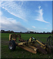
Farm machinery in a field
A large field south of Haynes Green Road. As the sky suggests, the next rains arrived within a few hours.
Image: © Andrew Hill Taken: 5 Dec 2009
0.23 miles
7
Footpath PROW 142_8
Heading towards Image
Image: © Glyn Baker Taken: 21 Apr 2020
0.23 miles
8
House by the edge of Layer Wood
Looking along Haynes Green Lane.
Image: © Andrew Hill Taken: 5 Dec 2009
0.24 miles
9
Haynes Green Road
PROW 142_8 is on the left it is 1109 metres long and goes from here to Image
Image: © Glyn Baker Taken: 21 Apr 2020
0.24 miles
10
Keeper's Cottages
Cottages associated with Layer Wood; on Haynes Green Road, viewed from the field footpath to the south west.
Image: © Trevor Harris Taken: 12 May 2016
0.25 miles