IMAGES TAKEN NEAR TO
Camellia Avenue, CLACTON-ON-SEA, CO16 7DE
Introduction
This page details the photographs taken nearby to Camellia Avenue, CO16 7DE by members of the Geograph project.
The Geograph project started in 2005 with the aim of publishing, organising and preserving representative images for every square kilometre of Great Britain, Ireland and the Isle of Man.

There are currently over 7.5m images from over14,400 individuals and you can help contribute to the project by visiting https://www.geograph.org.uk
Image Map
Images are licensed for reuse under creativecommons.org/licenses/by-sa/2.0
Notes
- Clicking on the map will re-center to the selected point.
- The higher the marker number, the further away the image location is from the centre of the postcode.
Image Listing (8 Images Found)
Images are licensed for reuse under creativecommons.org/licenses/by-sa/2.0
Image
Details
Distance
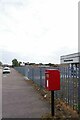
1
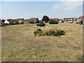
Southgreen Gardens
Raised public gardens surrounded by housing and accessible by road only from Ruaton Drive to the south. There are footpaths connecting them to the neighbouring residential streets: Lupin Way to the east and Camellia Crescent to the west.
Image: © Duncan Graham
Taken: 27 Jul 2018
0.05 miles
2
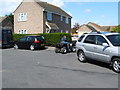
Marigold Avenue, Turning point April 2006
Marigold Avenue, Ruaton Gardens Estate, Clacton On Sea, Essex Turning point April 2006
Image: © malcolm rayment
Taken: 30 Apr 2006
0.14 miles
3
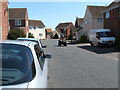
Looking down Marigold Avenue
Looking down Marigold Avenue on a nice sunny day in April 2006.
Image: © malcolm rayment
Taken: 30 Apr 2006
0.14 miles
4

Marigold Avenue on sunny April day 2006
Marigold Avenue Ruaton gardens, Clacton on sea, on sunny April day 2006
Image: © malcolm rayment
Taken: 30 Apr 2006
0.14 miles
5
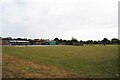
St Claire's Primary School Playing Field
Looking over the boundary fence.
Image: © Glyn Baker
Taken: 30 Sep 2023
0.16 miles
7

Clacton-on-Sea: Seventh-day Adventist Church
This building was originally the Wesleyan Mission Chapel and when it was built it was the only non-agricultural building in the hamlet of Coppen's Green. It was not until the 1950s that the urban residential development of Clacton-on-Sea began to catch up with it.
It has recently been refurbished by the Seventh-day Adventist Church, and, as can be judged by the number of vehicles in the car park, the Saturday afternoon Bible study sessions are popular.
The church's website is here http://clacton.adventistchurch.org.uk/
The road is Rush Green Road.
Image: © Nigel Cox
Taken: 16 Mar 2019
0.24 miles
8

Seventh-Day Adventist Church
This picture shows Clacton Seventh-Day Adventist Community Church, on Rush Green Road and opposite the end of Boxted Avenue.
The church building was constructed in 1893 (the date is in the roundel above the door to right of picture). On an 1896 map of the Clacton area, the church is shown as a Wesleyan Mission Chapel, with what was then the hamlet of Coppins Green just to the north. The chapel stood by the road leading south to the hamlet of Rush Green, farmland otherwise surrounding the building. The expanding seaside resort of Clacton-on-Sea has since engulfed the farmland and small settlements.
Image: © Duncan Graham
Taken: 27 Jul 2018
0.25 miles