IMAGES TAKEN NEAR TO
Warner Drive, CO14 8FX
Introduction
This page details the photographs taken nearby to Warner Drive, CO14 8FX by members of the Geograph project.
The Geograph project started in 2005 with the aim of publishing, organising and preserving representative images for every square kilometre of Great Britain, Ireland and the Isle of Man.

There are currently over 7.5m images from over14,400 individuals and you can help contribute to the project by visiting https://www.geograph.org.uk
Image Map
Images are licensed for reuse under creativecommons.org/licenses/by-sa/2.0
Notes
- Clicking on the map will re-center to the selected point.
- The higher the marker number, the further away the image location is from the centre of the postcode.
Image Listing (99 Images Found)
Images are licensed for reuse under creativecommons.org/licenses/by-sa/2.0
Image
Details
Distance
1
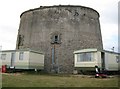
Walton-on-the-Naze: Martello Tower
Protection of the east coast of England from attack during the Napoleonic Wars was as important as that of the south coast as the government of the day were concerned in case an invasion was mounted to attack London through Essex and Suffolk. This is the Martello Tower at Walton-on-the-Naze, probably built around 1810, and located to guard over the numerous creeks north of Walton, rather than the sea.
The tower is not circular in plan but a curved structure with four main sides, about halfway between a circle and a square.
Although they were never put to the test the importance of these towers in the defence of the country after the threat during the Napoleonic War was over can be judged by the fact that they are not shown on the Ordnance Survey's 6" to the mile mapping editions of this area for 1880 and 1898, despite being of a scale large enough to be worth mapping. Only in 1925 do they suddenly appear, when presumably they were judged to be no longer of any military significance.
The land around the Walton-on-the-Naze tower is now used as a static residential and holiday home caravan park.
Image: © Nigel Cox
Taken: 30 Aug 2009
0.08 miles
3
Hebron Pentecostal Church, High Street: mid July
Image: © Basher Eyre
Taken: 18 Jul 2020
0.12 miles
4
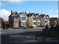
Looking north along Churchfield Street
The derelict building on the right used to be Walton Autos.
Image: © John Baker
Taken: 30 Mar 2014
0.13 miles
5
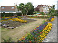
Walton-on-the-Naze: Walton Road garden
This attractive small public garden is on the north side of the B1336 Walton Road across the road junction from Image
Image: © Nigel Cox
Taken: 30 Aug 2009
0.13 miles
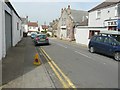
8
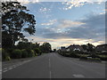
Looking west-southwest along Walton Road
Image: © Basher Eyre
Taken: 18 Jul 2020
0.14 miles
9
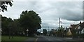
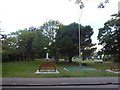
Walton Road, Walton-on-the-Naze
The town sign on the left is in an open space where there are seats and memorials
Image: © David Smith
Taken: 16 Jun 2014
0.14 miles
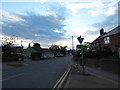
10
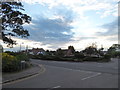
Staggered crossroads of Church, Kirby and Walton Roads
Image: © Basher Eyre
Taken: 18 Jul 2020
0.14 miles