Walton-on-the-Naze: Martello Tower
Introduction
The photograph on this page of Walton-on-the-Naze: Martello Tower by Nigel Cox as part of the Geograph project.
The Geograph project started in 2005 with the aim of publishing, organising and preserving representative images for every square kilometre of Great Britain, Ireland and the Isle of Man.

There are currently over 7.5m images from over 14,400 individuals and you can help contribute to the project by visiting https://www.geograph.org.uk
Walton-on-the-Naze: Martello Tower
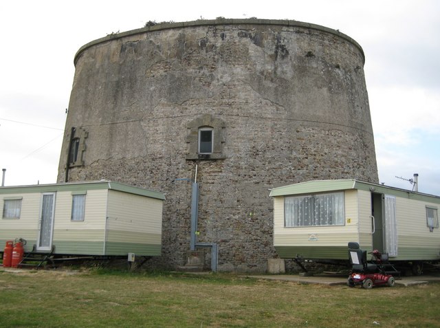
Image: © Nigel Cox Taken: 30 Aug 2009
Protection of the east coast of England from attack during the Napoleonic Wars was as important as that of the south coast as the government of the day were concerned in case an invasion was mounted to attack London through Essex and Suffolk. This is the Martello Tower at Walton-on-the-Naze, probably built around 1810, and located to guard over the numerous creeks north of Walton, rather than the sea. The tower is not circular in plan but a curved structure with four main sides, about halfway between a circle and a square. Although they were never put to the test the importance of these towers in the defence of the country after the threat during the Napoleonic War was over can be judged by the fact that they are not shown on the Ordnance Survey's 6" to the mile mapping editions of this area for 1880 and 1898, despite being of a scale large enough to be worth mapping. Only in 1925 do they suddenly appear, when presumably they were judged to be no longer of any military significance. The land around the Walton-on-the-Naze tower is now used as a static residential and holiday home caravan park.
Images are licensed for reuse under creativecommons.org/licenses/by-sa/2.0
Image Location
Latitude
51.851349
Longitude
1.267319