IMAGES TAKEN NEAR TO
Ray Lane, HARWICH, CO12 5HD
Introduction
This page details the photographs taken nearby to Ray Lane, CO12 5HD by members of the Geograph project.
The Geograph project started in 2005 with the aim of publishing, organising and preserving representative images for every square kilometre of Great Britain, Ireland and the Isle of Man.

There are currently over 7.5m images from over14,400 individuals and you can help contribute to the project by visiting https://www.geograph.org.uk
Image Map
Images are licensed for reuse under creativecommons.org/licenses/by-sa/2.0
Notes
- Clicking on the map will re-center to the selected point.
- The higher the marker number, the further away the image location is from the centre of the postcode.
Image Listing (10 Images Found)
Images are licensed for reuse under creativecommons.org/licenses/by-sa/2.0
Image
Details
Distance
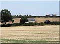
1
Towards White Cottage
The title is correct according to the 1:50,000 map but the 1:25,000 says the house is East Newhall Farm Cottage.
Image: © Glyn Baker
Taken: 3 Jul 2020
0.01 miles
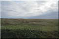
2
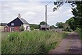
Ray Lane
The last few miles of the Essex Way https://www.ldwa.org.uk/ldp/members/show_path.php?path_name=Essex+Way
Image: © Glyn Baker
Taken: 3 Jul 2020
0.02 miles
3
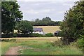
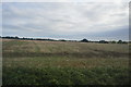
Farmland north of Ramsey
The house is White Cottage which stands on a trackway known as Ray Lane and the two tanks are part of a sewage works.
Image: © David Kemp
Taken: 11 Aug 2007
0.10 miles
5
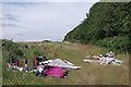
Fly Tip off Ray Lane
I always find this sort of thing so depressing.
Image: © Glyn Baker
Taken: 3 Jul 2020
0.14 miles
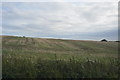
6
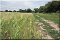
Essex Way and Ripening Barley
Heading towards Image on the Essex Way https://www.ldwa.org.uk/ldp/members/show_path.php?path_name=Essex+Way
Image: © Glyn Baker
Taken: 3 Jul 2020
0.16 miles
8
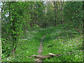
Woodland path, Stour Estuary Nature Trail
Path in woodland alongside Copperas Bay which links RSPB hides.
Image: © Roger Jones
Taken: 19 Apr 2014
0.18 miles
10

View from near East Newhall towards Erwarton Ness
Image: © flatland wanderer
Taken: 5 May 2008
0.24 miles