1
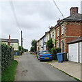
B1065 Skate's Hill, Glemsford
At the junction with Orchard Way
Image: © Geographer
Taken: 22 May 2014
0.04 miles
2
Glemsford: nearing New Cut
The footpath is part of a dense network at the southern end of this large Suffolk village.
Image: © John Sutton
Taken: 13 Aug 2021
0.05 miles
3
Glemsford: up New Cut
In the 19th and 20th centuries Glemsford was a centre for linen, silk, coconut matting and horsehair manufacture, and among the many picturesque and sometimes very old timber-framed houses there is a good number of Victorian terraces such as this one.
Image: © John Sutton
Taken: 13 Aug 2021
0.06 miles
4
Electricity installation on Skate's Hill, Glemsford
Image: © David Howard
Taken: 18 Apr 2017
0.07 miles
5
Glemsford Tyres on Skate's Hill
Image: © David Howard
Taken: 18 Apr 2017
0.07 miles
6
Glemsford: Egremont Street and New Cut
In the 19th and 20th centuries Glemsford was a centre for linen, silk, coconut matting and horsehair manufacture, and among the many picturesque and sometimes very old timber-framed houses there is a good number of Victorian terraces such as this one.
Image: © John Sutton
Taken: 13 Aug 2021
0.08 miles
7
Bungalows on Skate's Hill, Glemsford
Image: © David Howard
Taken: 18 Apr 2017
0.11 miles
8
Old Telephone Exchange, Glemsford
Off the B1065 Egremont Street at the junction with George Lane
Image: © Geographer
Taken: 22 May 2014
0.11 miles
9
Old Telephone Exchange, Glemsford
Off the B1065 Egremont Street at the junction with George Lane
Image: © Geographer
Taken: 22 May 2014
0.11 miles
10
Old Telephone Exchange, Glemsford
Off the B1065 Egremont Street at the junction with George Lane
(Close up)
Image: © Geographer
Taken: 22 May 2014
0.11 miles


