IMAGES TAKEN NEAR TO
Lower Road, SUDBURY, CO10 7QR
Introduction
This page details the photographs taken nearby to Lower Road, CO10 7QR by members of the Geograph project.
The Geograph project started in 2005 with the aim of publishing, organising and preserving representative images for every square kilometre of Great Britain, Ireland and the Isle of Man.

There are currently over 7.5m images from over14,400 individuals and you can help contribute to the project by visiting https://www.geograph.org.uk
Image Map (Loading...)


Getting Data...Please wait
Leaflet Map data © OpenStreetMap
Images are licensed for reuse under creativecommons.org/licenses/by-sa/2.0
Notes
- Clicking on the map will re-center to the selected point.
- The higher the marker number, the further away the image location is from the centre of the postcode.
Image Listing (42 Images Found)
Images are licensed for reuse under creativecommons.org/licenses/by-sa/2.0
Image
Details
Distance
1
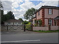
Glemsford railway station (site), Suffolk
Opened in 1866 by the Great Eastern Railway on the line from Marks Tey to Cambridge, this station closed in 1967.
View west towards Cavendish and Cambridge from the former level crossing. The single passenger platform was to the left of the image and is now partly covered by the garage of the former Station Master's residence (the building on the right). A second track ran along the side of the house to a goods platform. The former goods shed was also still extant when this image was taken, partly visible behind the former Station Master's house.
For more information, see http://www.disused-stations.org.uk/g/glemsford/index.shtml
Image: © Nigel Thompson
Taken: 1 Sep 2020
0.02 miles
2
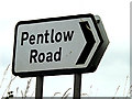
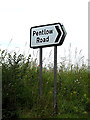
Pentlow Road sign
Off the A1092 Lower Road at the junction with Pentlow Road
(Close up)
Image: © Geographer
Taken: 14 Jun 2014
0.03 miles
3
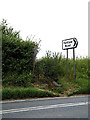
Pentlow Road sign
Off the A1092 Lower Road at the junction with Pentlow Road
Image: © Geographer
Taken: 14 Jun 2014
0.03 miles
4
Footpath to Flax Lane
Off the A1092 Lower Road at the junction with Pentlow Road
Image: © Geographer
Taken: 14 Jun 2014
0.03 miles
5
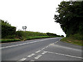
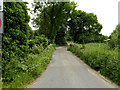
A1092 Lower Road, Glemsford
Looking towards Long Melford at the junction with Pentlow Road
Image: © Geographer
Taken: 14 Jun 2014
0.03 miles
6
Essex Suffolk Border
Unusually the sign for "Essex" was on the back of the Suffolk sign
Image: © Glyn Baker
Taken: 3 Jun 2021
0.04 miles
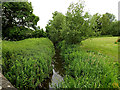
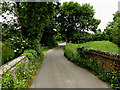
7
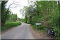
Pentlow Road, Glemsford
Looking towards the Essex/Suffolk Border & River Stour near the junction with the A1092 Lower Road
Image: © Geographer
Taken: 14 Jun 2014
0.04 miles
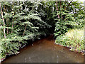
8
Pentlow Road, Glemsford
At the River Stour
Image: © Geographer
Taken: 14 Jun 2014
0.04 miles