IMAGES TAKEN NEAR TO
CO10 3EU

Introduction

This page details the photographs taken nearby to CO10 3EU by members of the Geograph project.

The Geograph project started in 2005 with the aim of publishing, organising and preserving representative images for every square kilometre of Great Britain, Ireland and the Isle of Man.

There are currently over 7.5m images from over14,400 individuals and you can help contribute to the project by visiting https://www.geograph.org.uk

Image Map


Images are licensed for reuse under creativecommons.org/licenses/by-sa/2.0
Notes
  • Clicking on the map will re-center to the selected point.
  • The higher the marker number, the further away the image location is from the centre of the postcode.

Image Listing (10 Images Found)

Images are licensed for reuse under creativecommons.org/licenses/by-sa/2.0
Image
Details
Distance
1
Interior of Church of St Mary, Chilton
https://historicengland.org.uk/listing/the-list/list-entry/1351732?section=official-list-entry
Image: © Sandy Gerrard Taken: 18 Apr 2023
0.09 miles
2
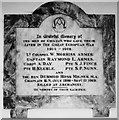
Chilton World War One Memorial
The memorial bears seven names.
Image: © Adrian S Pye Taken: 18 May 2016
0.09 miles
3
Church of St Mary, Chilton
https://historicengland.org.uk/listing/the-list/list-entry/1351732?section=official-list-entry
Image: © Sandy Gerrard Taken: 18 Apr 2023
0.09 miles
4
Chilton St Mary?s church
This church is regarded as remote and is always locked, although as the notice says there is nothing of value inside and to call the key-holder’s number for the key. (Better by far than no keyholder and no telephone to call). The church is 15th c and surrounded by trees. The brick tower is later and sits at the west of the nave. The crenellations are well defined and a slender pinnacle adorns each corner.
Image: © Adrian S Pye Taken: 29 Apr 2007
0.10 miles
5
St Mary Chilton
The church of St Mary Chilton Sudbury Suffolk. For more info see http://www.suffolkchurches.co.uk/chilton.html
Image: © Keith Evans Taken: 3 Aug 2008
0.10 miles
6
St. Mary's church, Chilton, Suffolk
The brick tower was built in the 16th century and the rest of the church, in the 15th. A few years ago this church stood all alone at the end of a small lane and with no village. Now, it has an industrial estate at its doorstep and it's gradually being swallowed up by the ever increasing town of Sudbury.
Image: © Robert Edwards Taken: 3 Apr 2006
0.11 miles
7
Part of Chilton Industrial Estate
The road is called Church Field Road.
Image: © Robert Edwards Taken: 4 Jul 2012
0.12 miles
8
Farm Track
Farm track leading to Grange Farm near to Great Cornard, Suffolk.
Image: © Keith Evans Taken: 20 Jun 2013
0.16 miles
9
Martins Road, Sudbury
Image: © Alex McGregor Taken: 11 Jan 2011
0.16 miles
10
Martin Buildbase, Sudbury
Image: © Oxyman Taken: 22 Mar 2008
0.20 miles