Chilton St Mary?s church
Introduction
The photograph on this page of Chilton St Mary?s church by Adrian S Pye as part of the Geograph project.
The Geograph project started in 2005 with the aim of publishing, organising and preserving representative images for every square kilometre of Great Britain, Ireland and the Isle of Man.

There are currently over 7.5m images from over 14,400 individuals and you can help contribute to the project by visiting https://www.geograph.org.uk
Chilton St Mary?s church
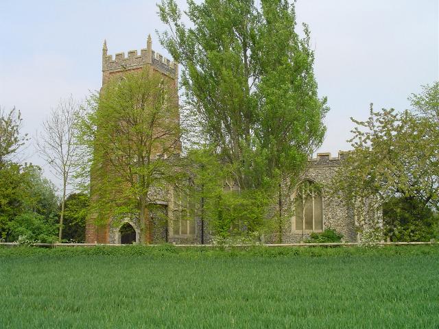
Image: © Adrian S Pye Taken: 29 Apr 2007
This church is regarded as remote and is always locked, although as the notice says there is nothing of value inside and to call the key-holder’s number for the key. (Better by far than no keyholder and no telephone to call). The church is 15th c and surrounded by trees. The brick tower is later and sits at the west of the nave. The crenellations are well defined and a slender pinnacle adorns each corner.
Images are licensed for reuse under creativecommons.org/licenses/by-sa/2.0
Image Location
Latitude
52.04616
Longitude
0.753944