IMAGES TAKEN NEAR TO
Stock Road, CHELMSFORD, CM2 8PS
Introduction
This page details the photographs taken nearby to Stock Road, CM2 8PS by members of the Geograph project.
The Geograph project started in 2005 with the aim of publishing, organising and preserving representative images for every square kilometre of Great Britain, Ireland and the Isle of Man.

There are currently over 7.5m images from over14,400 individuals and you can help contribute to the project by visiting https://www.geograph.org.uk
Image Map
Images are licensed for reuse under creativecommons.org/licenses/by-sa/2.0
Notes
- Clicking on the map will re-center to the selected point.
- The higher the marker number, the further away the image location is from the centre of the postcode.
Image Listing (20 Images Found)
Images are licensed for reuse under creativecommons.org/licenses/by-sa/2.0
Image
Details
Distance
2
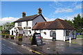
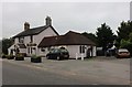
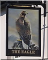
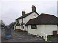
The Eagle, Galleywood, Chelmsford
On Stock Road.
Image: © JThomas
Taken: 11 May 2019
0.02 miles
4
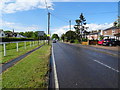
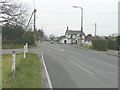
Stock Road, Galleywood , Chelmsford
Looking north on the B1007.
Image: © JThomas
Taken: 11 May 2019
0.02 miles
5
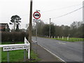
Crossroads at Galleywood
Seen from Margaretting Road, the main road is Stock Road (B1007) with Watchouse Road beyond.
Image: © John Baker
Taken: 28 Mar 2014
0.02 miles
8
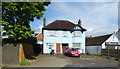
Blue house on Stock Road, Galleywood, Chelmsford
Image: © JThomas
Taken: 11 May 2019
0.05 miles
9
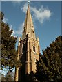
St. Michael & All Saints church at Galleywood Common
This was built in 1873 in the Gothic Revival style and designed by St Aubyn. The spire is quite tall and a landmark in this area.
Image: © Robert Edwards
Taken: 6 Feb 2008
0.13 miles
10
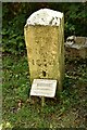
Ecclesiastical Parish boundary marker
Ecclesiastical Parish Boundary Marker in the churchyard of St Michael and All Angels' church. Galleywood parish. Inscribed G C / St M C C / 1874 (Galleywood Common St Michael Consolidated Chapelry). Originally sited in 1874 at Tile Kiln Farm, one of ten marking the boundary of Galleywood Common ecclesiastical parish. Found in Oaklands Park and moved to the church in 2004. Reference https://www.thegazette.co.uk/London/issue/24142/page/4766.
Milestone Society National ID: EX_GALLEY01pb
Image: © M Bardell
Taken: 12 Aug 2021
0.14 miles