Ecclesiastical Parish boundary marker
Introduction
The photograph on this page of Ecclesiastical Parish boundary marker by M Bardell as part of the Geograph project.
The Geograph project started in 2005 with the aim of publishing, organising and preserving representative images for every square kilometre of Great Britain, Ireland and the Isle of Man.

There are currently over 7.5m images from over 14,400 individuals and you can help contribute to the project by visiting https://www.geograph.org.uk
Ecclesiastical Parish boundary marker
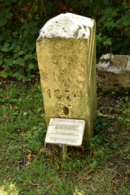
Image: © M Bardell Taken: 12 Aug 2021
Ecclesiastical Parish Boundary Marker in the churchyard of St Michael and All Angels' church. Galleywood parish. Inscribed G C / St M C C / 1874 (Galleywood Common St Michael Consolidated Chapelry). Originally sited in 1874 at Tile Kiln Farm, one of ten marking the boundary of Galleywood Common ecclesiastical parish. Found in Oaklands Park and moved to the church in 2004. Reference https://www.thegazette.co.uk/London/issue/24142/page/4766. Milestone Society National ID: EX_GALLEY01pb
Images are licensed for reuse under creativecommons.org/licenses/by-sa/2.0
Image Location
Latitude
51.699142
Longitude
0.463752