IMAGES TAKEN NEAR TO
Vernon Close, BISHOP'S STORTFORD, CM22 6AF
Introduction
This page details the photographs taken nearby to Vernon Close, CM22 6AF by members of the Geograph project.
The Geograph project started in 2005 with the aim of publishing, organising and preserving representative images for every square kilometre of Great Britain, Ireland and the Isle of Man.

There are currently over 7.5m images from over14,400 individuals and you can help contribute to the project by visiting https://www.geograph.org.uk
Image Map (Loading...)


Getting Data...Please wait
Leaflet Map data © OpenStreetMap
Images are licensed for reuse under creativecommons.org/licenses/by-sa/2.0
Notes
- Clicking on the map will re-center to the selected point.
- The higher the marker number, the further away the image location is from the centre of the postcode.
Image Listing (15 Images Found)
Images are licensed for reuse under creativecommons.org/licenses/by-sa/2.0
Image
Details
Distance
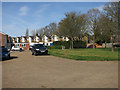
5
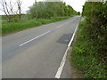
Mill Road
This is Mill Road as it leaves the southern edge of Henham.
Image: © Marathon
Taken: 14 May 2016
0.14 miles
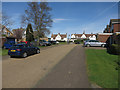
7
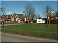
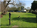
Village Green, Henham, Essex
This picture shows the interesting village sign on the right and the old Victorian school on the left, now a house conversion.
Image: © Robert Edwards
Taken: 5 Apr 2006
0.16 miles
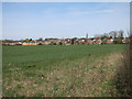
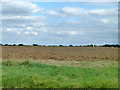
8
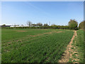
Path to Henham
This area is marked as playing fields on the map, but is a fallow dog walking area on the edge of Henham.
Image: © Hugh Venables
Taken: 12 Apr 2015
0.16 miles
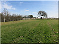
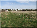
10
Footpath to Mill Road
Past Mill Pond Nurseries.
Image: © Hugh Venables
Taken: 12 Apr 2015
0.19 miles