IMAGES TAKEN NEAR TO
Greenstead, SAWBRIDGEWORTH, CM21 9NY
Introduction
This page details the photographs taken nearby to Greenstead, CM21 9NY by members of the Geograph project.
The Geograph project started in 2005 with the aim of publishing, organising and preserving representative images for every square kilometre of Great Britain, Ireland and the Isle of Man.

There are currently over 7.5m images from over14,400 individuals and you can help contribute to the project by visiting https://www.geograph.org.uk
Image Map (Loading...)


Getting Data...Please wait
Leaflet Map data © OpenStreetMap
Images are licensed for reuse under creativecommons.org/licenses/by-sa/2.0
Notes
- Clicking on the map will re-center to the selected point.
- The higher the marker number, the further away the image location is from the centre of the postcode.
Image Listing (34 Images Found)
Images are licensed for reuse under creativecommons.org/licenses/by-sa/2.0
Image
Details
Distance
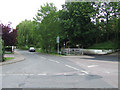
1
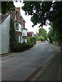
Vantorts Road
Looking up the hill towards Greenstead which is to the left beyond the house.
Image: © Thomas Nugent
Taken: 19 Jun 2010
0.06 miles
4
East Drive
Southbrook is to the left.
Image: © Thomas Nugent
Taken: 19 Jun 2010
0.06 miles
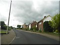
5
Southbrook
Springhall Lane is behind the fence, East Drive is the road in the foreground.
Image: © Thomas Nugent
Taken: 19 Jun 2010
0.07 miles
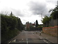
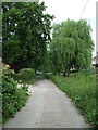
6
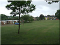
Park at Vantorts Close
The close is beyond the tree.
Image: © Thomas Nugent
Taken: 19 Jun 2010
0.11 miles
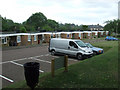
8
Park at Vantorts Close
The close is in the background.
Image: © Thomas Nugent
Taken: 19 Jun 2010
0.11 miles
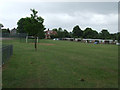
9
Springhall Lane
Approaching East Drive.
Image: © Thomas Nugent
Taken: 19 Jun 2010
0.12 miles
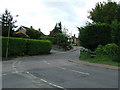
10
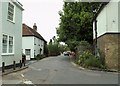
Part of Vantorts Road
The turning off to the left is Sheering Mill Lane.
Image: © Robert Edwards
Taken: 3 Jun 2009
0.15 miles