IMAGES TAKEN NEAR TO
Redricks Lane, SAWBRIDGEWORTH, CM21 0RL
Introduction
This page details the photographs taken nearby to Redricks Lane, CM21 0RL by members of the Geograph project.
The Geograph project started in 2005 with the aim of publishing, organising and preserving representative images for every square kilometre of Great Britain, Ireland and the Isle of Man.

There are currently over 7.5m images from over14,400 individuals and you can help contribute to the project by visiting https://www.geograph.org.uk
Image Map (Loading...)


Getting Data...Please wait
Leaflet Map data © OpenStreetMap
Images are licensed for reuse under creativecommons.org/licenses/by-sa/2.0
Notes
- Clicking on the map will re-center to the selected point.
- The higher the marker number, the further away the image location is from the centre of the postcode.
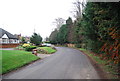
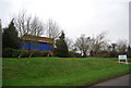
Image Listing (34 Images Found)
Images are licensed for reuse under creativecommons.org/licenses/by-sa/2.0
Image
Details
Distance
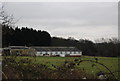
9
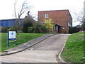
Three Valley Water Company offices at Harlow
Image: © Alan Kent
Taken: 15 Mar 2007
0.14 miles
10
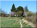
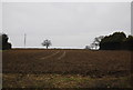
Footpath to Redricks Lane
This runs from the River Stort towpath, at first across a low-lying field that is liable to flooding - this is the dry bit.
Image: © Robin Webster
Taken: 16 Mar 2014
0.17 miles