IMAGES TAKEN NEAR TO
Fifth Avenue, CHELMSFORD, CM1 4HB
Introduction
This page details the photographs taken nearby to Fifth Avenue, CM1 4HB by members of the Geograph project.
The Geograph project started in 2005 with the aim of publishing, organising and preserving representative images for every square kilometre of Great Britain, Ireland and the Isle of Man.

There are currently over 7.5m images from over14,400 individuals and you can help contribute to the project by visiting https://www.geograph.org.uk
Image Map
Images are licensed for reuse under creativecommons.org/licenses/by-sa/2.0
Notes
- Clicking on the map will re-center to the selected point.
- The higher the marker number, the further away the image location is from the centre of the postcode.
Image Listing (13 Images Found)
Images are licensed for reuse under creativecommons.org/licenses/by-sa/2.0
Image
Details
Distance
1
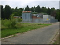
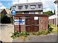
Electricity sub station
Alongside cyclepath, housing and allotments at the end of Fourth Avenue, within fencing.
Image: © William Metcalfe
Taken: 30 Apr 2007
0.09 miles
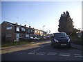
2
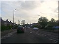
Broomfield Road at the junction of Patching Hall Lane
Image: © David Howard
Taken: 15 May 2012
0.12 miles
3
Electricity sub station
Hidden from main road by trees.
Image: © William Metcalfe
Taken: 25 Apr 2007
0.12 miles
4
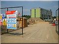
Building site at Anglia Ruskin University
New building work in front of the Tindal Building at Chelmsford's Anglia Ruskin University.
Image: © William Metcalfe
Taken: 4 May 2007
0.14 miles
6
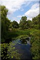
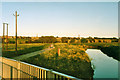
River Chelmer
The Chelmer in its non canalised form upstream of the Springfield Basin
Image: © Glyn Baker
Taken: 6 Aug 2006
0.15 miles
7
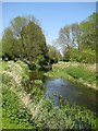
Spring on the river
The River Chelmer in fresh green
Image: © John Myers
Taken: 6 May 2008
0.17 miles
9
River Chelmer before the new road
An evening view looking from the fairly recent footbridge for the riverside walk to where the new road was to cross - just beyond the walkers. The white dot in the field on the right is a marking out peg, another is just visible on the river bank.
Image: © Robin Webster
Taken: Unknown
0.20 miles
10
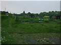
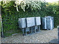
Allotments
Allotments viewed from the end of First Avenue.
Image: © William Metcalfe
Taken: 26 Apr 2007
0.21 miles