IMAGES TAKEN NEAR TO
Rhosesmor, MOLD, CH7 6PP
Introduction
This page details the photographs taken nearby to CH7 6PP by members of the Geograph project.
The Geograph project started in 2005 with the aim of publishing, organising and preserving representative images for every square kilometre of Great Britain, Ireland and the Isle of Man.

There are currently over 7.5m images from over14,400 individuals and you can help contribute to the project by visiting https://www.geograph.org.uk
Image Map
Images are licensed for reuse under creativecommons.org/licenses/by-sa/2.0
Notes
- Clicking on the map will re-center to the selected point.
- The higher the marker number, the further away the image location is from the centre of the postcode.
Image Listing (15 Images Found)
Images are licensed for reuse under creativecommons.org/licenses/by-sa/2.0
Image
Details
Distance
4
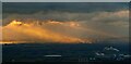
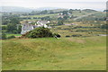
Rhosesmor
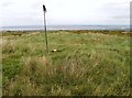
View from Moel Y Gaer looking east towards Connah's Quay on solstice sunrise.
Image: © Pete Hughes
Taken: 1 Jun 2013
0.14 miles
5
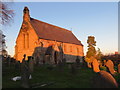
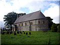
The church of St Paul at Rhosesmor bathed in late afternoon November sunshine
Viewed from the south-west.
Image: © Peter Wood
Taken: 18 Nov 2018
0.16 miles
6
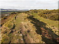
Moel-y-Gaer bronze age hillfort looking north-west
Image: © Roger Davies
Taken: 25 Jul 2010
0.17 miles
7
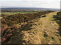
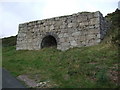
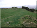
Ramparts and Ditch, Moel y Gaer, Rhosesmor
Iron Age hillfort.
Image: © Chris Andrews
Taken: 19 Feb 2023
0.17 miles
9
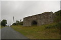
Moel y Gaer
Parked to NNE and used one of many paths to walk around summit rampards, then onto summit covered reservoir before finding wall of hollowed tumulus. Great views today.
Name: Moel y Gaer
Hill number: 5164
Height: 303.7m / 996ft
Area: 30C: Llandudno to Wrexham
Class: Hu
Grid ref: SJ 21068 69081
Summit feature: wall of hollowed tumulus
Drop: 126m
Col: 178m SJ106750
Image: © Rude Health
Taken: 17 Oct 2010
0.18 miles
10
Moel y Gaer hill fort
Part of the circular bank and ditch, some 180 metres in diameter. Believed to have been constructed between 2000 and 2500 years ago, it provided an excellent defendable site.
Image: © Adie Jackson
Taken: 10 Nov 2007
0.18 miles