1
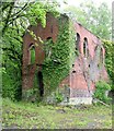
Engine house and chimney Taylor's Shaft, Hendre Mines
This engine house was built for an emergency pumping scheme in the lead mines during the First World War, using electric pumps in the shaft alongside. It was never finished. The tall brick chimney is possibly dated 1896.
Image: © John Harrison
Taken: 15 May 2007
0.05 miles
2
Former ore dressing house, North Hendre Lead Mine
Part of the development of this important lead mine from the last decade of the 19th century. Listed Grade II.
Image: © Alan Murray-Rust
Taken: 9 May 2019
0.06 miles
3
Taylor's Shaft Engine House and chimney, Hendre
The chimney is dated 1896 and the engine house probably dates from the same time. Both are separately Listed Grade II.
Image: © Alan Murray-Rust
Taken: 9 May 2019
0.06 miles
4
Stream and footpath in Nant Figillt
Originally in the middle of the North Hendre Lead Mine. The masonry just visible left and right formed the abutments of a bridge carrying a mine tramway across the stream.
Image: © Alan Murray-Rust
Taken: 9 May 2019
0.06 miles
5
Engine House at Taylor's Shaft, Hendre Lead Mines
WW1 lead mining buildings taken from the footbridge over the stream
Image: © John Harrison
Taken: 29 May 2006
0.07 miles
6
Taylor's Shaft Engine House, Hendre
Part of the former North Hendre Lead Mine, which was one of the most productive in the area, operating until 1938. The CADW listing (Grade II) suggests that this engine house was probably built in 1896, the date on the adjacent chimney http://www.geograph.org.uk/photo/6149966 . Other sources indicate that it was built in 1917 to house electric pumps, but the building is shown on the 1912 edition (surveyed 1910) of the 1:2500 OS map.
Image: © Alan Murray-Rust
Taken: 9 May 2019
0.07 miles
7
Engine House at Taylor's Shaft, Hendre Lead Mines
Engine House built during WW1 to revive the lead mines, and another similar building. The brick chimney is very tall.
Image: © John Harrison
Taken: 29 May 2006
0.07 miles
8
Buildings and chimneys at Hendre Lead Mine: aerial 2015
Image: © Chris
Taken: 2 Oct 2015
0.11 miles
9
Beehive kiln and chimney, Rhydymwyn
The last remaining structures of the Ruby brickworks at Rhydymwyn, probably late 19th century. Listed Grade II.
Image: © Alan Murray-Rust
Taken: 9 May 2019
0.13 miles
10
Hendre farmland
Image: © Dot Potter
Taken: 5 Mar 2006
0.19 miles


