Taylor's Shaft Engine House, Hendre
Introduction
The photograph on this page of Taylor's Shaft Engine House, Hendre by Alan Murray-Rust as part of the Geograph project.
The Geograph project started in 2005 with the aim of publishing, organising and preserving representative images for every square kilometre of Great Britain, Ireland and the Isle of Man.

There are currently over 7.5m images from over 14,400 individuals and you can help contribute to the project by visiting https://www.geograph.org.uk
Taylor's Shaft Engine House, Hendre
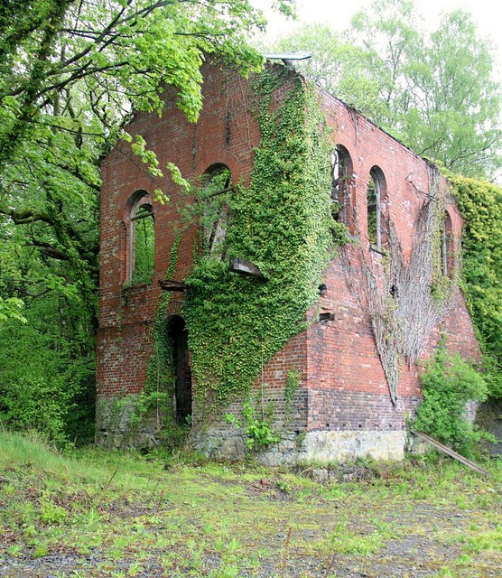
Image: © Alan Murray-Rust Taken: 9 May 2019
Part of the former North Hendre Lead Mine, which was one of the most productive in the area, operating until 1938. The CADW listing (Grade II) suggests that this engine house was probably built in 1896, the date on the adjacent chimney http://www.geograph.org.uk/photo/6149966 . Other sources indicate that it was built in 1917 to house electric pumps, but the building is shown on the 1912 edition (surveyed 1910) of the 1:2500 OS map.
Images are licensed for reuse under creativecommons.org/licenses/by-sa/2.0
Image Location
Latitude
53.201207
Longitude
-3.19265