
IMAGES TAKEN NEAR TO
Church Road, BUCKLEY, CH7 3JG
Introduction
This page details the photographs taken nearby to Church Road, CH7 3JG by members of the Geograph project.
The Geograph project started in 2005 with the aim of publishing, organising and preserving representative images for every square kilometre of Great Britain, Ireland and the Isle of Man.

There are currently over 7.5m images from over14,400 individuals and you can help contribute to the project by visiting https://www.geograph.org.uk
Image Map
Images are licensed for reuse under creativecommons.org/licenses/by-sa/2.0
Notes
- Clicking on the map will re-center to the selected point.
- The higher the marker number, the further away the image location is from the centre of the postcode.
Image Listing (57 Images Found)
Images are licensed for reuse under creativecommons.org/licenses/by-sa/2.0
Image
Details
Distance
2
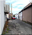
Daisy Hill Road, Buckley
From the north side of the A549 Brunswick Road, Daisy Hill Road leads to Linthorpe Gardens.
Image: © Jaggery
Taken: 12 Oct 2019
0.14 miles
3
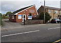
Brunswick Veterinary Surgery, Buckley
At 121-123 Brunswick Road on the north side of the A549.
Image: © Jaggery
Taken: 12 Oct 2019
0.16 miles
4
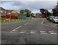
North along Church Road, Buckley
The B5128 Church Road viewed across the A549.
Image: © Jaggery
Taken: 12 Oct 2019
0.16 miles
5
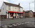
Bargain Booze, 121 Brunswick Road, Buckley
On the corner of Daisy Hill Road.
Image: © Jaggery
Taken: 12 Oct 2019
0.16 miles
6
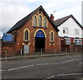
Buckley Christian Centre
On the north side of the A459 Brunswick Road in Buckley, Flintshire.
In October 2019 the nameboard shows BUCKLEY CHRISTIAN CENTRE - CHURCH TO THE NATIONS.
Image: © Jaggery
Taken: 12 Oct 2019
0.16 miles
7
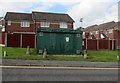
Church Road gas installation, Buckley
Viewed across the B5128 Church Road. The large green cabinet is a Wales & West Utilities gas installation.
Image: © Jaggery
Taken: 12 Oct 2019
0.16 miles
8

Buckley Christian Centre, 119 Brunswick Road
Buckley Christian Centre was formerly Our Lady of the Rosary RC church. there is an Ordnance Survey benchmark on the east side of the church, towards the side door: Image
Image: © John S Turner
Taken: 24 Aug 2018
0.16 miles
9
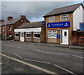
R.D.Davies & Son funeral directors, Brunswick Road, Buckley
In October 2019 the text on the nameboard includes A DIGNITY FUNERAL DIRECTOR.
Image: © Jaggery
Taken: 12 Oct 2019
0.16 miles
10
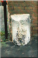
Old Milestone by the A549, Brunswick Road, Buckley
By the A549, in parish of Buckley (Flintshire District), West of Buckley Christian Centre, in pavement, back to brick wall, North side of road.
Inscription once read:- : (LANE END / ¼) : : (MOLD / 3) :
Surveyed
Milestone Society National ID: FLT_MDBK03
Image: © Milestone Society
Taken: Unknown
0.16 miles