IMAGES TAKEN NEAR TO
Waverley Drive, BUCKLEY, CH7 3FA
Introduction
This page details the photographs taken nearby to Waverley Drive, CH7 3FA by members of the Geograph project.
The Geograph project started in 2005 with the aim of publishing, organising and preserving representative images for every square kilometre of Great Britain, Ireland and the Isle of Man.

There are currently over 7.5m images from over14,400 individuals and you can help contribute to the project by visiting https://www.geograph.org.uk
Image Map
Images are licensed for reuse under creativecommons.org/licenses/by-sa/2.0
Notes
- Clicking on the map will re-center to the selected point.
- The higher the marker number, the further away the image location is from the centre of the postcode.
Image Listing (6 Images Found)
Images are licensed for reuse under creativecommons.org/licenses/by-sa/2.0
Image
Details
Distance
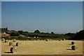
1
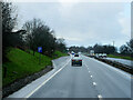
Roughly vegetated field beside the A55
The field is on the south-west side of a lay-by of the A55 dual carriageway close to the district of Drury, which appears to be either a part of Buckley or of Connah's Quay.
Image: © Trevor Littlewood
Taken: 8 Oct 2019
0.18 miles
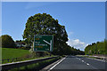
4
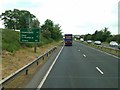
North Wales Expressway (A55), Layby near Ewloe
Image: © David Dixon
Taken: 14 Feb 2022
0.22 miles