1
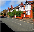
Bannel Lane bungalows, Buckley
The corner of Westbury Drive https://www.geograph.org.uk/photo/6295276 is on the left.
Image: © Jaggery
Taken: 12 Oct 2019
0.09 miles
2
Westbury Drive, Buckley
Cul-de-sac on the northeast side of Brook Street.
Image: © Jaggery
Taken: 12 Oct 2019
0.12 miles
3
Willowdale Residential Care Home in Buckley
At 112 Chester Road on the south side of the A549.
Image: © Jaggery
Taken: 12 Oct 2019
0.13 miles
4
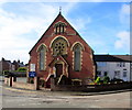
Bistre Methodist chapel, Buckley
On the corner of Brickfields and Spon Green.
Image: © Eirian Evans
Taken: 3 Dec 2008
0.13 miles
5
Chester Road bungalows, Buckley
Set back from the south side of the A549 Chester Road in the east of Buckley.
Image: © Jaggery
Taken: 12 Oct 2019
0.13 miles
6
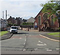
Spon Green, Buckley
Looking to the southwest from Brook Street along the road named Spon Green.
Bistre Methodist Chapel https://www.geograph.org.uk/photo/6296325 is on the corner of Brickfields.
Image: © Jaggery
Taken: 12 Oct 2019
0.14 miles
7
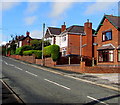
Houses and hedges on the north side of Chester Road, Buckley
Alongside the A549 Chester Road on the westward ascent towards Buckley town centre.
Image: © Jaggery
Taken: 12 Oct 2019
0.14 miles
8
Bistre Methodist Chapel, Buckley
On the corner of Spon Green and Brickfields, Bistre Methodist Chapel
is part of the Buckley and Deeside Methodist Circuit.
Image: © Jaggery
Taken: 12 Oct 2019
0.15 miles
9
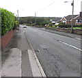
Down Chester Road, Buckley
The A549 Chester Road descends eastwards away from the centre of Buckley.
Ahead for the Station Road junction and Buckley railway station.
Image: © Jaggery
Taken: 12 Oct 2019
0.15 miles
10
North side of Chester Road, Buckley
Houses and hedges alongside the A549 Chester Road on the westward ascent towards Buckley town centre.
Image: © Jaggery
Taken: 12 Oct 2019
0.15 miles


