
IMAGES TAKEN NEAR TO
Moorefields, BUCKLEY, CH7 2AQ
Introduction
This page details the photographs taken nearby to Moorefields, CH7 2AQ by members of the Geograph project.
The Geograph project started in 2005 with the aim of publishing, organising and preserving representative images for every square kilometre of Great Britain, Ireland and the Isle of Man.

There are currently over 7.5m images from over14,400 individuals and you can help contribute to the project by visiting https://www.geograph.org.uk
Image Map
Images are licensed for reuse under creativecommons.org/licenses/by-sa/2.0
Notes
- Clicking on the map will re-center to the selected point.
- The higher the marker number, the further away the image location is from the centre of the postcode.
Image Listing (91 Images Found)
Images are licensed for reuse under creativecommons.org/licenses/by-sa/2.0
Image
Details
Distance
1
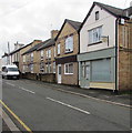
The Chiropody Shop, Buckley
On the right at 58 Brunswick Road.
Image: © Jaggery
Taken: 12 Oct 2019
0.07 miles
2
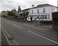
Lexham Green Residential Care Home, Buckley
At 50 Brunswick Road.
Image: © Jaggery
Taken: 12 Oct 2019
0.07 miles
3
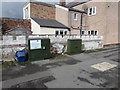
Two dark green cabinets, Coppa View, Buckley
Telecoms cabinets located here. https://www.geograph.org.uk/photo/6295667
Image: © Jaggery
Taken: 12 Oct 2019
0.07 miles
4
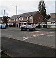
Coppa View speed bumps, Buckley
Painted white triangles draw attention to the bumps/humps across the road named Coppa View.
Image: © Jaggery
Taken: 12 Oct 2019
0.08 miles
5
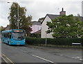
Mold bus on the A549 Brunswick Road, Buckley
Arriva Wales bus on route 4 from Chester railway station to Mold bus station in October 2019.
Image: © Jaggery
Taken: 12 Oct 2019
0.08 miles
6
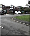
Lexham Green Close, Buckley
Cul-de-sac on the south side of the A549 Brunswick Road.
Image: © Jaggery
Taken: 12 Oct 2019
0.08 miles
7
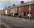
Brunswick Road houses, Buckley
On the north side of the A549 Brunswick Road.
Image: © Jaggery
Taken: 12 Oct 2019
0.08 miles
8
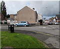
Junction of Coppa View and Brunswick Road, Buckley
From the left (south), the road named Coppa View joins the A549 Brunswick Road.
Image: © Jaggery
Taken: 12 Oct 2019
0.08 miles
9
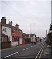
Buckley
The High Street in the Coppa View area of Buckley.
Image: © Eirian Evans
Taken: 15 Mar 2006
0.08 miles
10
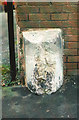
Old Milestone by the A549, Brunswick Road, Buckley
By the A549, in parish of Buckley (Flintshire District), West of Buckley Christian Centre, in pavement, back to brick wall, North side of road.
Inscription once read:- : (LANE END / ¼) : : (MOLD / 3) :
Surveyed
Milestone Society National ID: FLT_MDBK03
Image: © Milestone Society
Taken: Unknown
0.09 miles