IMAGES TAKEN NEAR TO
Truro Close, ELLESMERE PORT, CH66 2EY
Introduction
This page details the photographs taken nearby to Truro Close, CH66 2EY by members of the Geograph project.
The Geograph project started in 2005 with the aim of publishing, organising and preserving representative images for every square kilometre of Great Britain, Ireland and the Isle of Man.

There are currently over 7.5m images from over14,400 individuals and you can help contribute to the project by visiting https://www.geograph.org.uk
Image Map
Images are licensed for reuse under creativecommons.org/licenses/by-sa/2.0
Notes
- Clicking on the map will re-center to the selected point.
- The higher the marker number, the further away the image location is from the centre of the postcode.
Image Listing (12 Images Found)
Images are licensed for reuse under creativecommons.org/licenses/by-sa/2.0
Image
Details
Distance
1
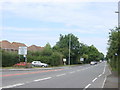
Chester Road (A41) from Backford Cross
Looking north from Backford Cross roundabout towards Great Sutton.
Image: © Sue Adair
Taken: 8 Aug 2006
0.10 miles
2
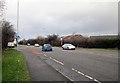
A41 (Chester Road), Backford Cross
Wikipedia http://en.wikipedia.org/wiki/Backford_Cross
Image: © Jeff Buck
Taken: 30 Jan 2013
0.10 miles
4
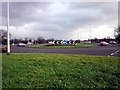
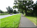
Backford Cross Roundabout
Backford Cross is located around the A41/A5117 junction.
Wikipedia http://en.wikipedia.org/wiki/Backford_Cross
Image: © Jeff Buck
Taken: 30 Jan 2013
0.14 miles
7
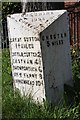
Old Milepost by the A41, north of Backford Cross
Cast iron post by the A41, in parish of Ellesmere Port (Ellesmere Port and Neston District), Sutton Lodge, on North West corner of junction, on the verge under tree, on North West side of road. Cast iron CCC1896, erected by the County Council in the 19th century.
Inscription reads:-
: GREAT SUTTON / 1½ MILES / LITTLE SUTTON 2 / EASTHAM 4½ / BROMBOROUGH 6 / NEW FERRY 8 / BIRKENHEAD 10½ : : CHESHIRE / 1896 / COUNTY COUNCIL : : CHESTER / 5 MILES :
Maker:-
: W H SMITH & CO / MAKERS / WHITCHURCH :
Milestone Society National ID: CH_CHBH05
Image: © J Higgins
Taken: 1 Jul 2004
0.19 miles
9
Willowdale Way, Ellesmere Port
In the suburbs.
Image: © JThomas
Taken: 15 Jun 2019
0.20 miles