1
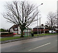
Julius Close, Flint
Cul-de-sac on the northwest side of Caesar Avenue.
Image: © Jaggery
Taken: 16 Jan 2017
0.02 miles
2
Caesar Avenue, Flint
From the corner of Chester Road.
Image: © Jaggery
Taken: 16 Jan 2017
0.04 miles
3
Caesar Avenue, Flint
Looking to the SSW along Caesar Avenue past the corner of Mill Croft.
Image: © Jaggery
Taken: 16 Jan 2017
0.06 miles
4
Old stone and brick wall, Chester Road, Flint
Image: © David Smith
Taken: 6 May 2023
0.07 miles
5
Mill Croft, Flint
Cul-de-sac on the southeast side of Caesar Avenue.
Image: © Jaggery
Taken: 16 Jan 2017
0.09 miles
6
Three bungalows in the outskirts of Flint
Viewed across the A548 Chester Road in the southeast of Flint.
Originally, bungalow was used in English for a lightly-built house, with a veranda and one storey.
In current UK usage it is a convenient word for any one-storey dwelling.
Image: © Jaggery
Taken: 16 Jan 2017
0.09 miles
7
Deeside Shuttle bus in the outskirts of Flint
Heading towards the town centre on the A548 Chester Road.
Image: © Jaggery
Taken: 16 Jan 2017
0.09 miles
8
Old Milestone by the A548, Chester Road, Pentre, Flint
Milestone by the A548, in parish of Flint (Flintshire District), by No. 253, Chester Road, against wall, Northeast side of road.
Inscription once read:-
: (Queensferry / 5 Miles) : : (Flint / 1 Mile) :
Surveyed
Milestone Society National ID: FLT_FLQF01
Image: © Milestone Society
Taken: Unknown
0.09 miles
9
Wales Coast Path signpost, Chester Road, Flint
The fingerpost points towards this http://www.geograph.org.uk/photo/5255708 path to the Dee Estuary.
Image: © Jaggery
Taken: 16 Jan 2017
0.10 miles
10
Tree and bus shelter at the SE edge of Flint
Viewed across the A548 Chester Road. The Oakenholt village boundary sign http://www.geograph.org.uk/photo/5255634 is on the right.
Image: © Jaggery
Taken: 16 Jan 2017
0.11 miles


