
IMAGES TAKEN NEAR TO
Percival Road, ELLESMERE PORT, CH65 2DF
Introduction
This page details the photographs taken nearby to Percival Road, CH65 2DF by members of the Geograph project.
The Geograph project started in 2005 with the aim of publishing, organising and preserving representative images for every square kilometre of Great Britain, Ireland and the Isle of Man.

There are currently over 7.5m images from over14,400 individuals and you can help contribute to the project by visiting https://www.geograph.org.uk
Image Map
Images are licensed for reuse under creativecommons.org/licenses/by-sa/2.0
Notes
- Clicking on the map will re-center to the selected point.
- The higher the marker number, the further away the image location is from the centre of the postcode.
Image Listing (35 Images Found)
Images are licensed for reuse under creativecommons.org/licenses/by-sa/2.0
Image
Details
Distance
1
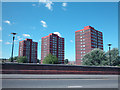
High Rise
High rise residential property to the north west of Ellesmere Port railway station.
Image: © Dennis Turner
Taken: 7 Aug 2005
0.11 miles
2
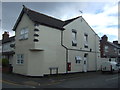
House on Westminster Road, Ellesmere Port
Showing position of Postbox No. CH65 340.
See Image] for postbox.
Image: © JThomas
Taken: 15 Jun 2019
0.14 miles
3
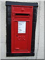
George V postbox on Westminster Road, Ellesmere Port
Postbox No. CH65 340.
See Image] for context.
Image: © JThomas
Taken: 15 Jun 2019
0.14 miles
4
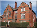
Old Court House, Westminster Road
The Old Court House and County Constabulary in Westminster Road used for Petty Court sessions from 1916 now converted into apartments.
Image: © Sue Adair
Taken: 14 Mar 2011
0.14 miles
5
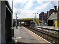
Ellesmere Port station, west end
A train leaves Ellesmere Port station, bound for Liverpool. It is passing under the bridge that carries Station Road, which is largely obscured from this side by the brightly painted footbridge. As well as linking the two station platforms, this latter links the two parts of Whitby Road, which is now severed by the railway but presumably once crossed it on the level. Certainly the architecture of the road bridge indicates that it is a lot newer than the railway.
Image: © Richard Vince
Taken: 26 Jun 2010
0.15 miles
6
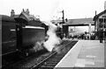
70004 ?William Shakespeare? at Ellesmere Port Station ? 1966
By this date the level crossing had been supplemented by the new road bridge, but was still open for traffic. More recently a footbridge https://www.geograph.org.uk/photo/2964022 has been built to enable passengers to cross the line without walking across the railway tracks. The line is now electrified.
Image: © Alan Murray-Rust
Taken: 22 Oct 1966
0.15 miles
7
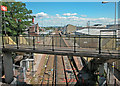
View from the bridge
Looking east at Ellesmere Port railway station.
Image: © Dennis Turner
Taken: 7 Aug 2005
0.15 miles
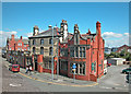
10
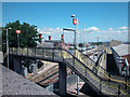
Ellesmere Port Station
View from road bridge built to replace a level crossing close to two busy road junctions.
Image: © Dennis Turner
Taken: 7 Aug 2005
0.15 miles