
IMAGES TAKEN NEAR TO
Eric Fountain Road, ELLESMERE PORT, CH65 1AX
Introduction
This page details the photographs taken nearby to Eric Fountain Road, CH65 1AX by members of the Geograph project.
The Geograph project started in 2005 with the aim of publishing, organising and preserving representative images for every square kilometre of Great Britain, Ireland and the Isle of Man.

There are currently over 7.5m images from over14,400 individuals and you can help contribute to the project by visiting https://www.geograph.org.uk
Image Map
Images are licensed for reuse under creativecommons.org/licenses/by-sa/2.0
Notes
- Clicking on the map will re-center to the selected point.
- The higher the marker number, the further away the image location is from the centre of the postcode.
Image Listing (13 Images Found)
Images are licensed for reuse under creativecommons.org/licenses/by-sa/2.0
Image
Details
Distance

2
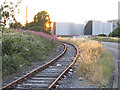
Freight line and oil storage tanks, Eastham
Eastham Oil Refinery is just behind these tanks, on a grid border.
Image: © Peter Craine
Taken: 27 Jul 2006
0.17 miles
3

WWII Cheshire: defences of the Wirral, RAF Hooton Park pillbox (1)
-
Pillbox (Type FW3/24): DoB ID: e43232
A type 24 pillbox in woodland alongside the Manchester Ship Canal, on the northern edge of the former airfield of RAF Hooton Park.
Image
Image: © Mike Searle
Taken: 31 Jul 2018
0.18 miles
4

WWII Cheshire: defences of the Wirral, RAF Hooton Park pillbox (2)
-
Pillbox (Type FW3/24): DoB ID: e43232
Image
Image: © Mike Searle
Taken: 31 Jul 2018
0.18 miles
5

WWII Cheshire: defences of the Wirral, RAF Hooton Park blast shelter (1)
-
Blast Shelter: DoB ID: e41545
A typical airfield blast shelter for aircrew and servicing crews, difficult to imagine today due to its location in woodland that presumably did not exist then during the Second World War. It now lies almost completely hidden and covered in ivy on the northern edge of the former airfield, close to the Manchester Ship Canal.
Image
Image: © Mike Searle
Taken: 31 Jul 2018
0.19 miles
6

WWII Cheshire: defences of the Wirral, RAF Hooton Park blast shelter (2)
-
Blast Shelter: DoB ID: e41545
Interior view. The blast shelter offered fairly basic protection compared to the more conventional underground air raid shelter. It consists of a narrow enclosed brick-built rectangular roofless structure with a single entrance in the middle of both sides.
Image
Image: © Mike Searle
Taken: 31 Jul 2018
0.19 miles

8

Manchester Ship Canal
View in the direction of Mount Manisty, with navigational beacon number 14 in the foreground.
Image: © Alan Heardman
Taken: 13 Jul 2014
0.22 miles
10

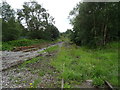
Cycle track beside North Road
Passing the motor Vauxhall car plant.
Image: © JThomas
Taken: 15 Jun 2019
0.24 miles