
IMAGES TAKEN NEAR TO
Boundary Park, NESTON, CH64 6TN
Introduction
This page details the photographs taken nearby to Boundary Park, CH64 6TN by members of the Geograph project.
The Geograph project started in 2005 with the aim of publishing, organising and preserving representative images for every square kilometre of Great Britain, Ireland and the Isle of Man.

There are currently over 7.5m images from over14,400 individuals and you can help contribute to the project by visiting https://www.geograph.org.uk
Image Map
Images are licensed for reuse under creativecommons.org/licenses/by-sa/2.0
Notes
- Clicking on the map will re-center to the selected point.
- The higher the marker number, the further away the image location is from the centre of the postcode.
Image Listing (19 Images Found)
Images are licensed for reuse under creativecommons.org/licenses/by-sa/2.0
Image
Details
Distance
1
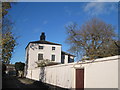
Rose Cottage, Old Quay Lane
Rose Cottage on Old Quay Lane, Moorside. On the opposite side of the lane stood The Manor House which demolished in the 1960's, only the adjacent Manor Cottages and Stable Cottages remain.
Image: © Sue Adair
Taken: 13 Nov 2018
0.05 miles
2
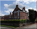
Springvale, Moorside
Front elevation of Springvale on the corner of Old Quay Lane, Moorside
Image: © Sue Adair
Taken: 8 Aug 2019
0.06 miles
3
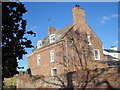
Springvale, Moorside Lane
Springvale on Moorside Lane from Old Quay Lane. Previously named Moorholme, in the 1880's this was the home of Colonel Richard and Mrs Gertrude Lacey.
Image: © Sue Adair
Taken: 13 Nov 2018
0.07 miles
4
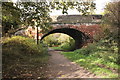
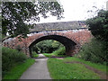
The Wirral Way at Moorside Lane Road Bridge
The Wirral Way heading northwest at Moorside Lane Road Bridge, Neston.
Wikipedia https://en.wikipedia.org/wiki/Wirral_Country_Park
Image: © Jeff Buck
Taken: 26 Oct 2016
0.08 miles
6
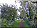
Neston (Moorside) - view along the Wirral Way
Neston (Moorside): view along the Wirral Way towards the footbridge just before Church Lane.
Image: © Mike Harris
Taken: 29 Oct 2006
0.14 miles
7
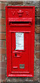
Victorian postbox on Parkgate Road, Neston
Postbox No. CH64 358.
Image: © JThomas
Taken: 25 May 2019
0.15 miles
9
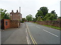
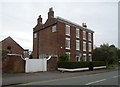
Parkgate Road, Neston
Looking north west on the B5135.
Image: © JThomas
Taken: 25 May 2019
0.16 miles
10
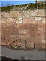
Cast Iron marker and wall by Parkgate Road
This cast iron marker and section of wall is on the corner of Parkgate Road and Buggen Lane. The cast iron marker can be seen in Image Above the marker the number 37 has been painted, and immediately above that the word 'POT' has been carved into the sandstone wall. The lettering of the word appears to be old but I don't know what it signifies. On all the old maps I have seen the modern day Buggen Lane is named Prospect Road.
Image: © John S Turner
Taken: 25 Jan 2009
0.16 miles