Cast Iron marker and wall by Parkgate Road
Introduction
The photograph on this page of Cast Iron marker and wall by Parkgate Road by John S Turner as part of the Geograph project.
The Geograph project started in 2005 with the aim of publishing, organising and preserving representative images for every square kilometre of Great Britain, Ireland and the Isle of Man.

There are currently over 7.5m images from over 14,400 individuals and you can help contribute to the project by visiting https://www.geograph.org.uk
Cast Iron marker and wall by Parkgate Road
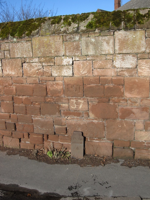
Image: © John S Turner Taken: 25 Jan 2009
This cast iron marker and section of wall is on the corner of Parkgate Road and Buggen Lane. The cast iron marker can be seen in Image Above the marker the number 37 has been painted, and immediately above that the word 'POT' has been carved into the sandstone wall. The lettering of the word appears to be old but I don't know what it signifies. On all the old maps I have seen the modern day Buggen Lane is named Prospect Road.
Images are licensed for reuse under creativecommons.org/licenses/by-sa/2.0
Image Location
Latitude
53.290915
Longitude
-3.070029