
IMAGES TAKEN NEAR TO
Wood Lane, NESTON, CH64 6QU
Introduction
This page details the photographs taken nearby to Wood Lane, CH64 6QU by members of the Geograph project.
The Geograph project started in 2005 with the aim of publishing, organising and preserving representative images for every square kilometre of Great Britain, Ireland and the Isle of Man.

There are currently over 7.5m images from over14,400 individuals and you can help contribute to the project by visiting https://www.geograph.org.uk
Image Map
Images are licensed for reuse under creativecommons.org/licenses/by-sa/2.0
Notes
- Clicking on the map will re-center to the selected point.
- The higher the marker number, the further away the image location is from the centre of the postcode.
Image Listing (68 Images Found)
Images are licensed for reuse under creativecommons.org/licenses/by-sa/2.0
Image
Details
Distance
1
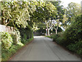
Wood Lane, Parkgate
Looking towards the junction with Earle Drive in this leafy suburban area.
Image: © Stephen McKay
Taken: 23 Sep 2023
0.13 miles
2
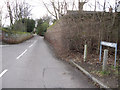
The top of Buggen Lane
Looking south-west down Buggen Lane from near its junction with Mill Street, on the left. Interestingly all the O.S. maps between 1882 and 1954 name this thoroughfare Prospect Road, and it is only in 1968 that the name Buggen Lane appears on the O.S. map.
Image: © John S Turner
Taken: 14 Feb 2011
0.13 miles
3
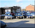
Supercar Classics in Neston
Car sales business alongside Liverpool Road.
Image: © Jaggery
Taken: 15 Feb 2018
0.14 miles
4
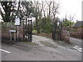
The gates to Townfield, Neston
The entrance to Townfield is at the junction of Mill Street and Buggen Lane. There is an old 'Prohibited all Vehicles' sign at the top of Mill Street, the same as the one at the bottom of the street Image Also there is a bench mark on the wall just to the left of the gate Image
Image: © John S Turner
Taken: 14 Feb 2011
0.14 miles
5
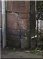
Bench mark in Mill Street
This bench mark is at the north end of Mill Street where it meets Buggen Lane, and next to the gates to Townfield. See also Image
Image: © John S Turner
Taken: 14 Feb 2011
0.14 miles
6
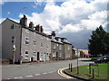
C18th houses in Park Street, Neston
18th century houses in Park Street, Neston. On the left, numbers 9-17 are over 200 years old, and there is a date of 1769 on number 11.
Image: © Sue Adair
Taken: 21 Jul 2010
0.15 miles
7
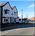
Malt Shovel, Neston
Pub at 35 Liverpool Road. https://www.geograph.org.uk/photo/5680637 to the name sign.
Image: © Jaggery
Taken: 15 Feb 2018
0.15 miles
8
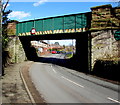
Liverpool Road railway bridge, Neston
The bridge carries the Borderlands Line railway over the B5136 Liverpool Road. Headroom shown is 13' 9"
Image: © Jaggery
Taken: 15 Feb 2018
0.15 miles
9
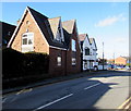
Liverpool Road house near the Malt Shovel, Neston
On the south side of the Malt Shovel pub. https://www.geograph.org.uk/photo/5680632
Image: © Jaggery
Taken: 15 Feb 2018
0.16 miles
10
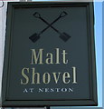
Malt Shovel at Neston name sign
Hanging from a wall bracket here. https://www.geograph.org.uk/photo/5680632
Image: © Jaggery
Taken: 15 Feb 2018
0.16 miles