
IMAGES TAKEN NEAR TO
Bromborough Business Park, Price's Way, WIRRAL, CH62 4LP
Introduction
This page details the photographs taken nearby to Bromborough Business Park, Price's Way, CH62 4LP by members of the Geograph project.
The Geograph project started in 2005 with the aim of publishing, organising and preserving representative images for every square kilometre of Great Britain, Ireland and the Isle of Man.

There are currently over 7.5m images from over14,400 individuals and you can help contribute to the project by visiting https://www.geograph.org.uk
Image Map
Images are licensed for reuse under creativecommons.org/licenses/by-sa/2.0
Notes
- Clicking on the map will re-center to the selected point.
- The higher the marker number, the further away the image location is from the centre of the postcode.
Image Listing (14 Images Found)
Images are licensed for reuse under creativecommons.org/licenses/by-sa/2.0
Image
Details
Distance
1
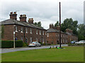
10-32 York Street, Bromborough Pool Village
An early model workers' village built for George and James Wilson whose Price's Patent Candle Company had relocated here from Battersea. These are among the earliest houses, built c1853. Each had three bedrooms, front and back garden, mains sanitation, parlour, kitchen and scullery. Grade II listed.
Image: © Stephen Richards
Taken: 21 Aug 2014
0.13 miles
2
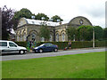
Former school, Bromborough Pool Village (2)
Built in 1858 by Julian Hill. Quite an unusual yellow-brick building. Grade II listed.
Now Giles Shirley Hall and used as a village hall/community centre
Image: © Stephen Richards
Taken: 21 Aug 2014
0.16 miles
3
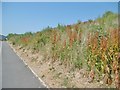
Port Sunlight, park
River Park, created from a former landfill site, capped in 2006, covered with membranes and clay, and seeded. Now a good site for scrubland plants and animals. https://thelandtrust.org.uk/space/port-sunlight-river-park/?doing_wp_cron=1531073259.5924420356750488281250
Image: © Mike Faherty
Taken: 5 Jul 2018
0.17 miles
4
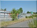
Port Sunlight, plant
Here, methane and carbon dioxide from the neighbouring landfill site are collected and converted to electricity, and leachate from the site is treated and sent to the sewage system. https://thelandtrust.org.uk/space/port-sunlight-river-park/?doing_wp_cron=1531073259.5924420356750488281250
Image: © Mike Faherty
Taken: 5 Jul 2018
0.17 miles
5
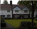
Port Sunlight House
An example of the houses built by Lord Leverhulme for his workers at Port Sunlight
Image: © phil smith
Taken: 18 May 2005
0.19 miles
6
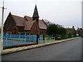
St Matthew's Church, Bromborough Pool
Built in 1890 by Price’s who had the candle factory in Bromborough Pool for many years.
Image: © Peter Holmes
Taken: 27 Feb 2010
0.19 miles
7
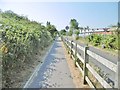
Port Sunlight, path
Along the perimeter of the former landfill site; waste treatment plane, right. https://thelandtrust.org.uk/space/port-sunlight-river-park/?doing_wp_cron=1531073259.5924420356750488281250
Image: © Mike Faherty
Taken: 5 Jul 2018
0.19 miles
8
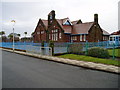
The Enterprise Centre
School run by the Wirral Autistic Society.
Image: © Peter Holmes
Taken: 27 Feb 2010
0.20 miles
9
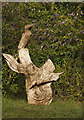
A wood sculpture
Opened in 2014 this former landfill site had become a community eyesore, looming over the A41 and visible from the historic Port Sunlight village, and restricting public access. Previous uses of the site created a mental and physical barrier between neighbourhoods and restricted access to the waterfront and all associated benefits, including stunning views across the Mersey and rich habitats for an assortment of wildlife. http://thelandtrust.org.uk/space/port-sunlight-river-park/
Image: © Ian Greig
Taken: 14 Jul 2017
0.21 miles
10
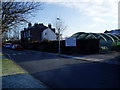
Raby Hall Garden Centre, Bromborough Pool
Situated on The Green and run by the Wirral Autistic Society.
Image: © Peter Holmes
Taken: 2 Mar 2010
0.21 miles