IMAGES TAKEN NEAR TO
Oakridge Close, WIRRAL, CH62 2AT
Introduction
This page details the photographs taken nearby to Oakridge Close, CH62 2AT by members of the Geograph project.
The Geograph project started in 2005 with the aim of publishing, organising and preserving representative images for every square kilometre of Great Britain, Ireland and the Isle of Man.

There are currently over 7.5m images from over14,400 individuals and you can help contribute to the project by visiting https://www.geograph.org.uk
Image Map (Loading...)


Getting Data...Please wait
Leaflet Map data © OpenStreetMap
Images are licensed for reuse under creativecommons.org/licenses/by-sa/2.0
Notes
- Clicking on the map will re-center to the selected point.
- The higher the marker number, the further away the image location is from the centre of the postcode.
Image Listing (18 Images Found)
Images are licensed for reuse under creativecommons.org/licenses/by-sa/2.0
Image
Details
Distance
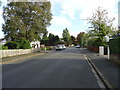
4
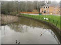
Binsdale Brook, Bromborough
Looking down from Bromborough Road into Binsdale Brook. The top of a road cone and the rear wheels of an almost submerged shopping trolley help to give the scene a typically urban feeling.
Image: © Graham Robson
Taken: 12 Mar 2016
0.14 miles
5
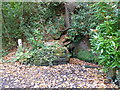
St Patricks Well in Brotherton Park
Image: © Raymond Knapman
Taken: 31 Oct 2014
0.14 miles
6
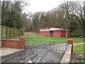
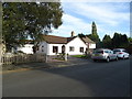
Pumping Station, Bromborough
This anonymous building is identified by Ordnance Survey on their maps as a pumping station.
Image: © Graham Robson
Taken: 12 Mar 2016
0.14 miles
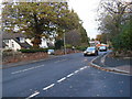
7
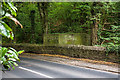
WWII Cheshire: Defences of the Wirral, Bromborough Road pillbox
-
Pillbox (variant): DoB ID: S0006164
A second pillbox lies further E along Bromborough Road, NW of its junction with Spital Road. Its primary purpose was to guard a roadblock on Bromborough Road.
START:- Image
Image: © Mike Searle
Taken: 30 Jul 2018
0.16 miles
8
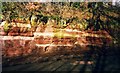
Fault line in the sandstone in Mill Road, Bromborough.
This is a nice Horst and Graben fault, tensional forces have pulled the rocks apart meaning the graben (middle section) has dropped downwards.
Image: © Donald Farnworth
Taken: Unknown
0.16 miles