
IMAGES TAKEN NEAR TO
Spital Road, WIRRAL, CH62 2AF
Introduction
This page details the photographs taken nearby to Spital Road, CH62 2AF by members of the Geograph project.
The Geograph project started in 2005 with the aim of publishing, organising and preserving representative images for every square kilometre of Great Britain, Ireland and the Isle of Man.

There are currently over 7.5m images from over14,400 individuals and you can help contribute to the project by visiting https://www.geograph.org.uk
Image Map
Images are licensed for reuse under creativecommons.org/licenses/by-sa/2.0
Notes
- Clicking on the map will re-center to the selected point.
- The higher the marker number, the further away the image location is from the centre of the postcode.
Image Listing (13 Images Found)
Images are licensed for reuse under creativecommons.org/licenses/by-sa/2.0
Image
Details
Distance
1
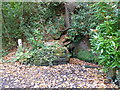
St Patricks Well in Brotherton Park
Image: © Raymond Knapman
Taken: 31 Oct 2014
0.08 miles
2
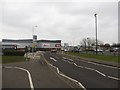
Welton Road, Bromborough
Welton Road bisects the Croft Retail Park in Bromborough.
Image: © Graham Robson
Taken: 12 Mar 2016
0.16 miles
3
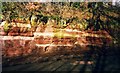
Fault line in the sandstone in Mill Road, Bromborough.
This is a nice Horst and Graben fault, tensional forces have pulled the rocks apart meaning the graben (middle section) has dropped downwards.
Image: © Donald Farnworth
Taken: Unknown
0.17 miles
4
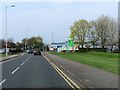
Welton Road on the South Wirral Retail Park
Image: © Steve Daniels
Taken: 1 Apr 2019
0.18 miles
5
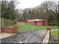
Pumping Station, Bromborough
This anonymous building is identified by Ordnance Survey on their maps as a pumping station.
Image: © Graham Robson
Taken: 12 Mar 2016
0.20 miles
6
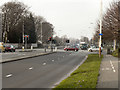
New Chester Road, Bromborough
The junction of New Chester Road (A41) with Croft Avenue East (B5137) at Bromborough.
Image: © David Dixon
Taken: 3 Mar 2011
0.20 miles
7
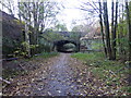
A41 road bridge in Bromborough
The bridge crosses a dismantled railway which once served Port Sunlight Soap Works. Now converted to a cycle way.
Image: © Raymond Knapman
Taken: 31 Oct 2014
0.21 miles
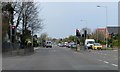
10
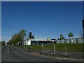
Caldbeck Road, Bromborough
An industrial estate with trees lining some of the roads
Image: © David Smith
Taken: 28 Apr 2024
0.22 miles