
IMAGES TAKEN NEAR TO
Shorefields, WIRRAL, CH62 1DF
Introduction
This page details the photographs taken nearby to Shorefields, CH62 1DF by members of the Geograph project.
The Geograph project started in 2005 with the aim of publishing, organising and preserving representative images for every square kilometre of Great Britain, Ireland and the Isle of Man.

There are currently over 7.5m images from over14,400 individuals and you can help contribute to the project by visiting https://www.geograph.org.uk
Image Map
Images are licensed for reuse under creativecommons.org/licenses/by-sa/2.0
Notes
- Clicking on the map will re-center to the selected point.
- The higher the marker number, the further away the image location is from the centre of the postcode.
Image Listing (14 Images Found)
Images are licensed for reuse under creativecommons.org/licenses/by-sa/2.0
Image
Details
Distance
2
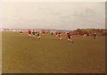
Mayfields, New Ferry, April 1976
The playing fields these Under-13s were playing on was previously a brickworks up until the 1950s. The "hill" to the right is an uncompleted landfill (it remains to this day uncompleted!) The current view from this location includes a further higher uncompleted landfill behind the landfill in this picture. To think that landfills are supposed to be converted to parks and open spaces within a year of their termination of landfill operations makes one think aghastly toward the local council. This area is one of the most deprived of the borough and to this day local Councillors still ignore it!
Image: © mezmrz
Taken: 11 Apr 1976
0.10 miles
5
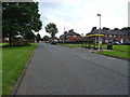
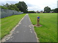
Bus stop and shelter on Shorefields, New Ferry
Image: © JThomas
Taken: 15 Jun 2019
0.18 miles
7
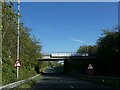
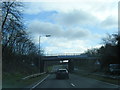
New Ferry Road bridge over New Ferry Bypass
With a banner carrying a safety message
Image: © David Smith
Taken: 28 Apr 2024
0.19 miles
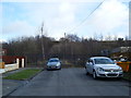
10
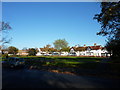
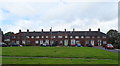
Houses, Port Sunlight
At the north end of the garden village.Light and open spaces were considered very important for his tenants and workforce, by Lord Leverhulme.
In 1887,William Lever, as he was then,bought 56 acres of land on the Wirral in Cheshire between the River Mersey and the railway line at Bebington. This site became Port Sunlight where he built his works and a model village to house its employees. From 1888, Port Sunlight village offered decent living conditions in the belief that good housing would ensure a healthy and happy workforce.
Image: © Peter Barr
Taken: 5 Nov 2012
0.21 miles