
IMAGES TAKEN NEAR TO
Mountain View Close, DEESIDE, CH5 4HH
Introduction
This page details the photographs taken nearby to Mountain View Close, CH5 4HH by members of the Geograph project.
The Geograph project started in 2005 with the aim of publishing, organising and preserving representative images for every square kilometre of Great Britain, Ireland and the Isle of Man.

There are currently over 7.5m images from over14,400 individuals and you can help contribute to the project by visiting https://www.geograph.org.uk
Image Map
Images are licensed for reuse under creativecommons.org/licenses/by-sa/2.0
Notes
- Clicking on the map will re-center to the selected point.
- The higher the marker number, the further away the image location is from the centre of the postcode.
Image Listing (5 Images Found)
Images are licensed for reuse under creativecommons.org/licenses/by-sa/2.0
Image
Details
Distance
1
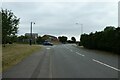
Wepre Lane meets Ffordd Newydd
Looking along a residential street beside Wepre Park.
Image: © DS Pugh
Taken: 8 Aug 2020
0.05 miles
2
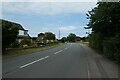
Along Wepre Lane
Looking along a residential street beside Wepre Park.
Image: © DS Pugh
Taken: 8 Aug 2020
0.09 miles
3
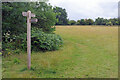
Wepre footpaths
There is a junction of paths here beside Wepre Wood - heading to Wepre Brook, Wepre Lane or the Devil's Basin.
Image: © Stephen McKay
Taken: 11 Jul 2023
0.15 miles

5
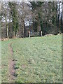
Footpath to Ewloe Castle
From the B5125. The arms of Llywelyn ap Gruffydd, the last prince of Wales, are painted on either side of the gate. It was he who built Ewloe Castle after he reclaimed Ewloe Forest from the lordship of Hawarden in 1257.
Image: © Eirian Evans
Taken: 1 Mar 2008
0.25 miles