IMAGES TAKEN NEAR TO
Powys Close, DEESIDE, CH5 2FA
Introduction
This page details the photographs taken nearby to Powys Close, CH5 2FA by members of the Geograph project.
The Geograph project started in 2005 with the aim of publishing, organising and preserving representative images for every square kilometre of Great Britain, Ireland and the Isle of Man.

There are currently over 7.5m images from over14,400 individuals and you can help contribute to the project by visiting https://www.geograph.org.uk
Image Map
Images are licensed for reuse under creativecommons.org/licenses/by-sa/2.0
Notes
- Clicking on the map will re-center to the selected point.
- The higher the marker number, the further away the image location is from the centre of the postcode.
Image Listing (23 Images Found)
Images are licensed for reuse under creativecommons.org/licenses/by-sa/2.0
Image
Details
Distance
2
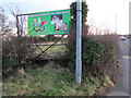
Blocked field gate by the A550, Gladstone Way, Queensferry
There is an Ordnance Survey benchmark on the stone gatepost that is hidden in the hawthorn hedge near the lamp post Image
Image: © John S Turner
Taken: 10 Jan 2020
0.12 miles
3
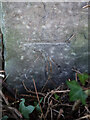
Benchmark by the A550, Gladstone Way, Queensferry
Ordnance Survey benchmark on a stone post by the A550, Gladstone Way, Queensferry. The post and cut mark are very well hidden by a hawthorn hedge. The mark was levelled at 12.369m above Newlyn Datum, verified 1958. For a wider view of the hedge corner see: Image
Benchmark Database: https://www.bench-marks.org.uk/bm114903
Image: © John S Turner
Taken: 10 Jan 2020
0.12 miles
5
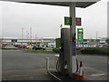
Fuel pumps at ASDA
At Clay Hill, near Queensferry.
Image: © M J Richardson
Taken: 12 Apr 2018
0.18 miles
6

The Blessed Trinity
Dedication of this Queensferry Roman Catholic church.
Image: © Dennis Turner
Taken: 29 Apr 2009
0.19 miles
7

Station Road
Shops in the road which previously the main coastal route taking traffic from the north west England conurbations of Liverpool and Manchester to the North Wales coastal resorts of Rhyl Prestatyn and Colwyn Bay.
Image: © Dennis Turner
Taken: 29 Apr 2009
0.19 miles
8

ASDA car park looking towards petrol station
Image: © John Firth
Taken: 1 Mar 2010
0.19 miles
9
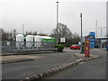
Service station exit, Queensferry
With car wash and an enclosure for propane gas storage tanks.
Image: © M J Richardson
Taken: 12 Apr 2018
0.19 miles