
IMAGES TAKEN NEAR TO
Clay Hill Lane, DEESIDE, CH5 2AQ
Introduction
This page details the photographs taken nearby to Clay Hill Lane, CH5 2AQ by members of the Geograph project.
The Geograph project started in 2005 with the aim of publishing, organising and preserving representative images for every square kilometre of Great Britain, Ireland and the Isle of Man.

There are currently over 7.5m images from over14,400 individuals and you can help contribute to the project by visiting https://www.geograph.org.uk
Image Map
Images are licensed for reuse under creativecommons.org/licenses/by-sa/2.0
Notes
- Clicking on the map will re-center to the selected point.
- The higher the marker number, the further away the image location is from the centre of the postcode.
Image Listing (12 Images Found)
Images are licensed for reuse under creativecommons.org/licenses/by-sa/2.0
Image
Details
Distance
1
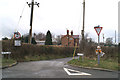
Tragic reminder
Fading flowers around a street sign commemorate a road death on the A550 near Hawarden
Image: © David Long
Taken: 6 Mar 2006
0.08 miles
3
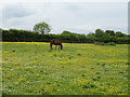
Grazing near Oak House Farm
West of Gladstone Way.
Image: © JThomas
Taken: 25 May 2019
0.10 miles
4
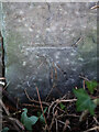
Benchmark by the A550, Gladstone Way, Queensferry
Ordnance Survey benchmark on a stone post by the A550, Gladstone Way, Queensferry. The post and cut mark are very well hidden by a hawthorn hedge. The mark was levelled at 12.369m above Newlyn Datum, verified 1958. For a wider view of the hedge corner see: Image
Benchmark Database: https://www.bench-marks.org.uk/bm114903
Image: © John S Turner
Taken: 10 Jan 2020
0.13 miles
5
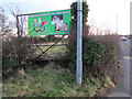
Blocked field gate by the A550, Gladstone Way, Queensferry
There is an Ordnance Survey benchmark on the stone gatepost that is hidden in the hawthorn hedge near the lamp post Image
Image: © John S Turner
Taken: 10 Jan 2020
0.13 miles
6
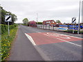
A550 outside Daleside Garden Centre
Looking along the A550 in the direction of Queensferry from opposite the entrance to Daleside Garden Centre.
Image: © John S Turner
Taken: 29 Apr 2010
0.23 miles
8
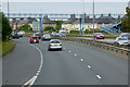
Queensferry, Footbridge over Aston Road (A494)
Image: © David Dixon
Taken: 24 Sep 2017
0.23 miles
9
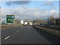
A494 - footbridge at Queensferry
The junction sign is curious. Birkenhead is now shown (compare with http://www.geograph.org.uk/photo/2252268), but the route is A494. In reality, beyond this junction the road number changes to A550. Possibly someone decided the sign applies to the flyover which, technically, is still the A494 until the A550 slip roads join it. The route between Ewloe and the M56 would benefit from renumbering with a single, continuous route number.
Image: © Peter Whatley
Taken: 18 Jan 2011
0.23 miles
