
IMAGES TAKEN NEAR TO
New Hey Road, WIRRAL, CH49 9BY
Introduction
This page details the photographs taken nearby to New Hey Road, CH49 9BY by members of the Geograph project.
The Geograph project started in 2005 with the aim of publishing, organising and preserving representative images for every square kilometre of Great Britain, Ireland and the Isle of Man.

There are currently over 7.5m images from over14,400 individuals and you can help contribute to the project by visiting https://www.geograph.org.uk
Image Map
Images are licensed for reuse under creativecommons.org/licenses/by-sa/2.0
Notes
- Clicking on the map will re-center to the selected point.
- The higher the marker number, the further away the image location is from the centre of the postcode.
Image Listing (3 Images Found)
Images are licensed for reuse under creativecommons.org/licenses/by-sa/2.0
Image
Details
Distance
1
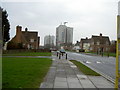
Woodchurch Estate
A typical view of the Woodchurch estate, a large housing estate that has completely engulfed the former Woodchurch hamlet. There use to be more tower blocks, such as those in the picture, on the Upton by-pass, but these were torn down.
Image: © David Quinn
Taken: 22 Dec 2007
0.17 miles
2
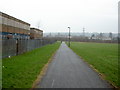
National Cycle Network near Woodchurch
The tarmac path was built in the early 2000's as part of Sustran's National Route 56 between Liverpool and Chester. Being where it is, the path is littered with graffiti markings in places and it is not uncommon for there to be broken glass on the path every morning. The building on the left is the former St. Benedict's Comprehensive School, which itself is now looking derelict.
Image: © David Quinn
Taken: 22 Dec 2007
0.21 miles
3
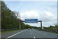
Motorway sign gantry over M53 in advance of J2
Image: © David Smith
Taken: 28 Apr 2024
0.23 miles