
IMAGES TAKEN NEAR TO
Elder Drive, CHESTER, CH4 8PF
Introduction
This page details the photographs taken nearby to Elder Drive, CH4 8PF by members of the Geograph project.
The Geograph project started in 2005 with the aim of publishing, organising and preserving representative images for every square kilometre of Great Britain, Ireland and the Isle of Man.

There are currently over 7.5m images from over14,400 individuals and you can help contribute to the project by visiting https://www.geograph.org.uk
Image Map
Images are licensed for reuse under creativecommons.org/licenses/by-sa/2.0
Notes
- Clicking on the map will re-center to the selected point.
- The higher the marker number, the further away the image location is from the centre of the postcode.
Image Listing (14 Images Found)
Images are licensed for reuse under creativecommons.org/licenses/by-sa/2.0
Image
Details
Distance
3
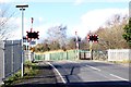
Greenlane Crossing, Lache
The Chester-Wrexham rail crossing at the Lache.
Image: © Jeff Buck
Taken: 24 Feb 2014
0.12 miles
4
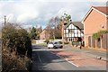
Green Lane, Lache
Wikipedia http://en.wikipedia.org/wiki/Lache
Image: © Jeff Buck
Taken: 24 Feb 2014
0.13 miles
5
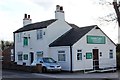
Green Lane Veterinary Centre
Wikipedia http://en.wikipedia.org/wiki/Lache
Image: © Jeff Buck
Taken: 24 Feb 2014
0.15 miles
6
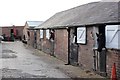
Green Lane Farm Riding School, Lache
Green Lane Farm Riding School, Lache.
Image: © Jeff Buck
Taken: 24 Feb 2014
0.16 miles
7
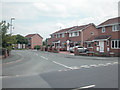
Houses
About one third of this square is housing, mainly built post WW2, the remainder is farmland.
Image: © Dennis Turner
Taken: 18 Aug 2005
0.17 miles
8
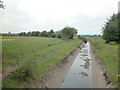
Drainage Channel
Channel drains into Balderton Brook which drains into the River Dee in Saltney http://www.geograph.org.uk/photo/44988
Image: © Dennis Turner
Taken: 18 Aug 2005
0.18 miles
9
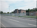
Pumping Station
Sewage has to be pumped to the Sewage treatment plant in low lying areas.
Image: © Dennis Turner
Taken: 18 Aug 2005
0.20 miles
10
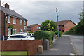
Boundary Lane, Saltney
At first glance, this might be dismissed as a wholly unremarkable slice of suburbia but the road has the distinction of running along the border between England and Wales, so the houses on the left are in Flintshire and those on the right are within the Cheshire West and Chester unitary authority area. There is nothing here to indicate this situation, although the name of the street gives a clue.
Image: © Stephen McKay
Taken: 14 Jun 2018
0.23 miles