
IMAGES TAKEN NEAR TO
Hough Green, CHESTER, CH4 8JS
Introduction
This page details the photographs taken nearby to Hough Green, CH4 8JS by members of the Geograph project.
The Geograph project started in 2005 with the aim of publishing, organising and preserving representative images for every square kilometre of Great Britain, Ireland and the Isle of Man.

There are currently over 7.5m images from over14,400 individuals and you can help contribute to the project by visiting https://www.geograph.org.uk
Image Map
Images are licensed for reuse under creativecommons.org/licenses/by-sa/2.0
Notes
- Clicking on the map will re-center to the selected point.
- The higher the marker number, the further away the image location is from the centre of the postcode.
Image Listing (28 Images Found)
Images are licensed for reuse under creativecommons.org/licenses/by-sa/2.0
Image
Details
Distance
1

Elizabeth II postbox on Hough Green, Chester
Postbox No. CH4 62.
Image: © JThomas
Taken: 19 Apr 2024
0.04 miles
2
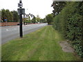
Hough Green towards Chester
Looking along Hough Green towards Chester. There was once a First Geodetic Levelling bench mark in this area on a stone over a gully, but it seems to have been destroyed many year ago. The concrete panels in the ground now cover GPO equipment. The white Victorian building in the distance is the Youth Hostel, which is up for sale.
Image: © John S Turner
Taken: 18 Sep 2009
0.05 miles
3
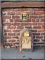
Fire Hydrant Sign on Hough Green
This old Fire Point sign set in a sandstone block has far more character than the modern yellow 'H' sign. However, it probably took a lot longer to set up the old one. The fire hydrant access plate is behind the camera.
Image: © John S Turner
Taken: 17 Feb 2007
0.05 miles
4
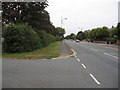
Hough Green away from Chester
Looking along Hough Green in the direction of Saltney. The road to the left, also known as Hough Green, accesses a row of 1970s houses. The large hedge on the left does not have a bank or associated ditch, but whether it be new or old it follows the old hedge line shown on the 19th century maps. Somewhere near the lamppost there was once a First Geodetic Levelling bench mark on a stone over a gully, but there is no sign of it now, and in fact it is not shown after 1874 on any map that I have seen.
Image: © John S Turner
Taken: 18 Sep 2009
0.05 miles
5
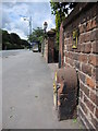
Bench mark and Hough Green
Looking west along Hough Green in front of the former Redland Hotel. Immediately on the right the sandstone block carries an old 'FP' fire hydrant plate, whilst the modern version is attached to the wall above it. On this side of the sandstone block there is a bench mark. For a later 2023 photo see: https://www.geograph.org.uk/photo/7404860
BMD log: https://www.bench-marks.org.uk/bm31210
Image: © John S Turner
Taken: 6 Jul 2009
0.06 miles
6
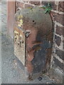
Damaged stone and benchmark by 62 Hough Green, Chester
This old stone carries an FP plate and also has an Ordnance Survey benchmark on its east face. The stone and benchmark have suffered some damage since my 2009 photo Image
BMDlink: https://www.bench-marks.org.uk/bm31210
Image: © John S Turner
Taken: 11 Feb 2023
0.06 miles
7
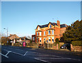
Redlands House, Hough Green
One of a number of large 19th century houses along here.
Image: © Des Blenkinsopp
Taken: 31 Jan 2013
0.07 miles
8
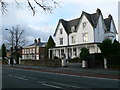
Chester Youth Hostel
A large Victorian house, built in 1856, now houses a youth hostel. It is on Hough Green.
Image: © Eirian Evans
Taken: 7 Dec 2007
0.07 miles
9
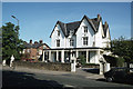
Former Chester Youth Hostel, Hough Green
Image: © Colin Park
Taken: 29 May 1982
0.07 miles
10
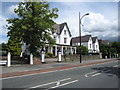
Chester Youth Hostel 2009
A sunny picture of what was once the Chester Youth Hostel on Hough Green. Citing the excessive cost of upgrading as the reason for disposal, in September 2009 the hostel has been sold. The YHA website now states that there is alternative accommodation at "...YHA Liverpool (25 miles) or YHA Manchester (41 miles)"!
Image: © John S Turner
Taken: 6 Jul 2009
0.08 miles