Damaged stone and benchmark by 62 Hough Green, Chester
Introduction
The photograph on this page of Damaged stone and benchmark by 62 Hough Green, Chester by John S Turner as part of the Geograph project.
The Geograph project started in 2005 with the aim of publishing, organising and preserving representative images for every square kilometre of Great Britain, Ireland and the Isle of Man.

There are currently over 7.5m images from over 14,400 individuals and you can help contribute to the project by visiting https://www.geograph.org.uk
Damaged stone and benchmark by 62 Hough Green, Chester
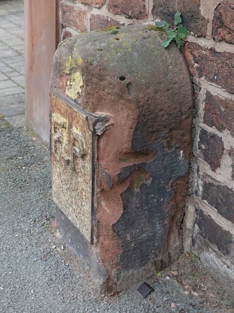
Image: © John S Turner Taken: 11 Feb 2023
This old stone carries an FP plate and also has an Ordnance Survey benchmark on its east face. The stone and benchmark have suffered some damage since my 2009 photo Image BMDlink: https://www.bench-marks.org.uk/bm31210
Images are licensed for reuse under creativecommons.org/licenses/by-sa/2.0
Image Location
Latitude
53.179063
Longitude
-2.906315